Ban Thi District
Ban Thi (Thai: บ้านธิ, pronounced [bâːn tʰíʔ]) is the northernmost district (amphoe) of Lamphun Province, northern Thailand.
Ban Thi
บ้านธิ | |
|---|---|
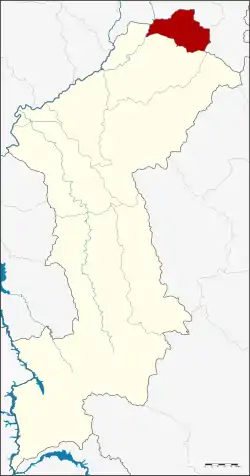 District location in Lamphun Province | |
| Coordinates: 18°39′6″N 99°7′30″E | |
| Country | Thailand |
| Province | Lamphun |
| Seat | Ban Thi |
| Area | |
| • Total | 129.0 km2 (49.8 sq mi) |
| Population (2005) | |
| • Total | 17,607 |
| • Density | 136.5/km2 (354/sq mi) |
| Time zone | UTC+7 (ICT) |
| Postal code | 51180 |
| Geocode | 5107 |
Etymology
The district is named after the Thi River, and literally means 'Thi village'.
History
The minor district (king amphoe) Ban Thi was established on 1 April 1990, when two tambons were split off from Mueang Lamphun District.[1] It was upgraded to a full district on 7 September 1995.[2]
Geography
Neighboring districts are Mueang Lamphun of Lamphun Province to the south and San Kamphaeng of Chiang Mai Province to the north.
The main river of the district is the Thi River, which originates in the Mae Thai mountain range in the east of the district. The river flows into the Mae Kuang River, a tributary of the Ping.
Administration
The district is divided into two sub-districts (tambons), which are further subdivided into 34 villages (muban). Ban Thi is a township (thesaban tambon) which covers the whole tambon Ban Thi. There is one tambon administrative organizations (TAO). The sub-district of Ban Thi will be the site of the second Chiang Mai Airport.
| No. | Name | Thai name | Villages | Pop. | |
|---|---|---|---|---|---|
| 1. | Ban Thi | บ้านธิ | 19 | 9,496 | |
| 2. | Huai Yap | ห้วยยาบ | 15 | 8,111 |
References
- ประกาศกระทรวงมหาดไทย เรื่อง แบ่งเขตท้องที่อำเภอเมืองลำพูน จังหวัดลำพูน ตั้งเป็นกิ่งอำเภอบ้านธิ (PDF). Royal Gazette (in Thai). 107 (25 ง): 1358. February 13, 1990.
- พระราชกฤษฎีกาตั้งอำเภอด่านมะขามเตี้ย อำเภอแก่งหางแมว อำเภอภักดีชุมพล อำเภอเวียงแก่น อำเภอแม่วาง อำเภอถ้ำพรรณรา อำเภอบ่อเกลือ อำเภอโนนสุวรรณ อำเภอห้วยราช อำเภอแม่ลาน อำเภอบางแก้ว อำเภอป่าพะยอม อำเภอหนองม่วงไข่ อำเภอยางสีสุราช อำเภอจังหาร อำเภอบ้านธิ อำเภอภูสิงห์ อำเภอบางกล่ำ อำเภอวังม่วง และอำเภอนายูง พ.ศ. ๒๕๓๘ (PDF). Royal Gazette (in Thai). 112 (32 ก): 1–3. August 8, 1995.