Bancroft, Iowa
Bancroft is a city in Kossuth County, Iowa, United States. The population was 732 at the 2010 census.
Bancroft, Iowa | |
|---|---|
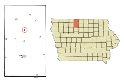 Location of Bancroft, Iowa | |
| Coordinates: 43°17′34″N 94°13′1″W | |
| Country | |
| State | |
| County | Kossuth |
| Area | |
| • Total | 0.56 sq mi (1.44 km2) |
| • Land | 0.56 sq mi (1.44 km2) |
| • Water | 0.00 sq mi (0.00 km2) |
| Elevation | 1,181 ft (360 m) |
| Population | |
| • Total | 732 |
| • Estimate (2019)[3] | 696 |
| • Density | 1,249.55/sq mi (482.71/km2) |
| Time zone | UTC-6 (Central (CST)) |
| • Summer (DST) | UTC-5 (CDT) |
| ZIP code | 50517 |
| Area code(s) | 515 |
| FIPS code | 19-04420 |
| GNIS feature ID | 0454341 |
History
Bancroft was platted in 1881.[4] It was named for George Bancroft, an American historian.[5]
Geography
Bancroft is located at 43°17′34″N 94°13′1″W (43.292791, -94.217063).[6]
According to the United States Census Bureau, the city has a total area of 0.55 square miles (1.42 km2), all land.[7]
Demographics
| Year | Pop. | ±% |
|---|---|---|
| 1890 | 657 | — |
| 1900 | 839 | +27.7% |
| 1910 | 830 | −1.1% |
| 1920 | 902 | +8.7% |
| 1930 | 854 | −5.3% |
| 1940 | 959 | +12.3% |
| 1950 | 901 | −6.0% |
| 1960 | 1,000 | +11.0% |
| 1970 | 1,103 | +10.3% |
| 1980 | 1,082 | −1.9% |
| 1990 | 857 | −20.8% |
| 2000 | 808 | −5.7% |
| 2010 | 732 | −9.4% |
| 2019 | 696 | −4.9% |
| Source:"U.S. Census website". United States Census Bureau. Retrieved 2020-03-28. and Iowa Data Center Source: | ||
2010 census
As of the census[2] of 2010, there were 732 people, 311 households, and 189 families living in the city. The population density was 1,330.9 inhabitants per square mile (513.9/km2). There were 360 housing units at an average density of 654.5 per square mile (252.7/km2). The racial makeup of the city was 98.8% White, 0.1% African American, 0.3% Native American, 0.1% from other races, and 0.7% from two or more races. Hispanic or Latino of any race were 0.3% of the population.
There were 311 households, of which 27.0% had children under the age of 18 living with them, 47.9% were married couples living together, 8.4% had a female householder with no husband present, 4.5% had a male householder with no wife present, and 39.2% were non-families. 36.0% of all households were made up of individuals, and 17.4% had someone living alone who was 65 years of age or older. The average household size was 2.26 and the average family size was 2.94.
The median age in the city was 44.9 years. 25.5% of residents were under the age of 18; 4.6% were between the ages of 18 and 24; 20% were from 25 to 44; 24.3% were from 45 to 64; and 25.5% were 65 years of age or older. The gender makeup of the city was 50.4% male and 49.6% female.
2000 census
As of the census[9] of 2000, there were 808 people, 339 households, and 208 families living in the city. The population density was 1,484.2 people per square mile (577.7/km2). There were 372 housing units at an average density of 683.3 per square mile (266.0/km2). The racial makeup of the city was 99.50% White, 0.37% from other races, and 0.12% from two or more races. Hispanic or Latino of any race were 1.24% of the population.
There were 339 households, out of which 28.6% had children under the age of 18 living with them, 50.7% were married couples living together, 8.6% had a female householder with no husband present, and 38.6% were non-families. 37.2% of all households were made up of individuals, and 21.8% had someone living alone who was 65 years of age or older. The average household size was 2.27 and the average family size was 2.99.
In the city, the population was spread out, with 25.9% under the age of 18, 6.4% from 18 to 24, 22.3% from 25 to 44, 18.3% from 45 to 64, and 27.1% who were 65 years of age or older. The median age was 42 years. For every 100 females, there were 82.8 males. For every 100 females age 18 and over, there were 82.6 males.
The median income for a household in the city was $31,055, and the median income for a family was $35,625. Males had a median income of $29,688 versus $18,929 for females. The per capita income for the city was $15,312. About 9.1% of families and 12.7% of the population were below the poverty line, including 17.7% of those under age 18 and 8.6% of those age 65 or over.
Education
It is a part of the North Kossuth Community School District.[10]
Notable people
- Joe Hatten, Major League Baseball pitcher.
- Denis Menke, MLB player, coach, and two-time National League All-Star.[11]
- Randy Rahe, College basketball coach.
References
- "2019 U.S. Gazetteer Files". United States Census Bureau. Retrieved July 17, 2020.
- "U.S. Census website". United States Census Bureau. Retrieved 2012-05-11.
- "Population and Housing Unit Estimates". United States Census Bureau. May 24, 2020. Retrieved May 27, 2020.
- Reed, Benjamin F. (1913). History of Kossuth County, Iowa, Volume 1. S. J. Clarke Publishing Company. p. 675.
- Chicago and North Western Railway Company (1908). A History of the Origin of the Place Names Connected with the Chicago & North Western and Chicago, St. Paul, Minneapolis & Omaha Railways. p. 41.
- "US Gazetteer files: 2010, 2000, and 1990". United States Census Bureau. 2011-02-12. Retrieved 2011-04-23.
- "US Gazetteer files 2010". United States Census Bureau. Archived from the original on January 12, 2012. Retrieved 2012-05-11.
- "Census of Population and Housing". Census.gov. Retrieved June 4, 2015.
- "U.S. Census website". United States Census Bureau. Retrieved 2008-01-31.
- "North Kossuth Archived 2018-04-27 at the Wayback Machine." Iowa Department of Education. Retrieved on July 15, 2018.
- "Denis Menke". BASEBALL-Reference. Retrieved January 26, 2011.
External links
- City website
- First Baptist Church website
- City-Data Comprehensive Statistical Data and more about Bancroft
Municipalities and communities of Kossuth County, Iowa, United States | ||
|---|---|---|
| Cities | Map of Iowa highlighting Kossuth County | |
| Townships | ||
| CDPs | ||
| Unincorporated communities | ||
| Ghost town | ||
| Footnotes | ‡This populated place also has portions in an adjacent county or counties | |
| ||
| Authority control |
|---|