Baraga Township, Michigan
Baraga Township is a civil township of Baraga County in the U.S. state of Michigan. As of the 2010 census, the township population was 3,815.[3] The village of Baraga is located in the southeast corner of the township.
Baraga Township, Michigan | |
|---|---|
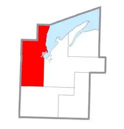 Location within Baraga County (red) and the administered village of Baraga (pink) | |
 Baraga Township Location within the state of Michigan | |
| Coordinates: 46°44′19″N 88°34′19″W | |
| Country | United States |
| State | Michigan |
| County | Baraga |
| Area | |
| • Total | 187.2 sq mi (484.8 km2) |
| • Land | 183.8 sq mi (476.0 km2) |
| • Water | 3.4 sq mi (8.8 km2) |
| Elevation | 863 ft (263 m) |
| Population (2010) | |
| • Total | 3,815 |
| • Density | 21/sq mi (8.0/km2) |
| Time zone | UTC-5 (Eastern (EST)) |
| • Summer (DST) | UTC-4 (EDT) |
| ZIP code | |
| Area code(s) | 906 |
| FIPS code | 26-05340[1] |
| GNIS feature ID | 1625882[2] |
| Website | Official website |
Communities
- Arnheim is an unincorporated community at 46°55′01″N 88°28′57″W.[4] Arnheim was a station on the Duluth, South Shore and Atlantic Railway, midway between L'Anse and Houghton. Storekeeper Martin Erikson became the first postmaster on November 13, 1900. The office closed in either 1915 or 1916[5] and reopened from August 15, 1917, until September 30, 1951.[6][7] Arnheim was named after Jeremiah Arn (died 1911). Jeremiah Arn was employed to strip the Portage Entry quarries until the over-burden of stone was removed. He settled on a farm at Arnheim and started a quarry which he worked for many years. [8]
- Assinins is an unincorporated community at 46°48′37″N 88°28′38″W.[9] Assinins was founded in 1843 by Catholic missionary Frederic Baraga, who named it for an Assiniboin chief whom Baraga had converted and who remained Baraga's devoted friend. In the 1870s, the settlement was known as the "Catholic Mission". The first post office in the area was named "Fewsville" from 1872, after Gershom B. Few, who operated a distillery, and George W. Few, who became the first postmaster on September 22, 1875. The office closed in 1877. It reopened as "Assinins" on December 6, 1894, with Simon Denomie as the first postmaster and discontinued on May 31, 1914.[6][10]
- Baraga is a village at the junction of US Highway 41 and M-38 in the east-central portion of the township. The Baraga ZIP code 49908 serves a region in the central part of the township.[11]
- Bear Town is a named place on US Highway 41 north of Baraga at 46°48′32″N 88°30′35″W.[12]
- Fewsville – see Assinins.[6]
- Keweenaw Bay is an unincorporated community at 46°51′37″N 88°28′54″W.[13] A land patent was issued to Frank Laffrenire by US President Ulysses S. Grant on May 10, 1875. The settlement was known as "Leffenire" until 1898. Annie La Fernier became the first postmaster on March 26, 1898, with the office named "La Fernier". However Annie had it changed on June 1, 1901, to the name of the large bay on which the village was located. The post office was discontinued on January 16, 1976, and became a CPO of Baraga. It was also a station on the Duluth, South Shore and Atlantic Railway. "Keweenaw" (kewawenon) was a Native American word for portage.[6][14]
- Pelkie is an unincorporated community in the northeast part of the township. The Pelkie ZIP code 49958 serves areas in the northern and northwestern parts of the township.[15]
Geography
According to the United States Census Bureau, Baraga Township has a total area of 187.2 square miles (484.8 km2), of which 183.8 square miles (476.0 km2) is land and 3.4 square miles (8.8 km2), or 1.82%, is water.[3]
Demographics
As of the 2000 United States Census,[1] there were 3,542 people, 1,178 households, and 777 families in the township. The population density was 19.1 per square mile (7.4/km2). There were 1,455 housing units at an average density of 7.8 per square mile (3.0/km2). The racial makeup of the township was 67.56% White, 12.11% African American, 14.00% Native American, 0.40% Asian, 0.48% from other races, and 5.45% from two or more races. Hispanic or Latino of any race were 1.19% of the population. 28.3% were of Finnish, 9.6% German and 8.8% French ancestry according to the 2000 census.
There were 1,178 households, out of which 33.6% had children under the age of 18 living with them, 49.6% were married couples living together, 11.8% had a female householder with no husband present, and 34.0% were non-families. 30.0% of all households were made up of individuals, and 13.3% had someone living alone who was 65 years of age or older. The average household size was 2.49 and the average family size was 3.10.
The township population contained 23.6% under the age of 18, 8.7% from 18 to 24, 34.4% from 25 to 44, 21.3% from 45 to 64, and 11.9% who were 65 years of age or older. The median age was 35 years. For every 100 females, there were 136.6 males. For every 100 females age 18 and over, there were 147.9 males.
The median income for a household in the township was $32,639, and the median income for a family was $41,750. Males had a median income of $32,373 versus $23,516 for females. The per capita income for the township was $14,550. About 8.2% of families and 11.8% of the population were below the poverty line, including 15.0% of those under age 18 and 11.8% of those age 65 or over.
References
- "U.S. Census website". US Census Bureau. Retrieved January 31, 2008.
- U.S. Geological Survey Geographic Names Information System: Baraga Township, Michigan
- "Geographic Identifiers: 2010 Demographic Profile Data (G001): Baraga township, Baraga County, Michigan". US Census Bureau, American Factfinder. Archived from the original on February 12, 2020. Retrieved December 24, 2013.
- U.S. Geological Survey Geographic Names Information System: Arnheim, Michigan
- Romig indicates September 19, 1915 while the GNIS citing David M. Ellis, Michigan Postal History, The Post Offices 1805-1986 indicates July 31, 1916
- Romig, Walter (1986) [1973]. Michigan Place Names. Detroit: Wayne State University Press. p. 195. ISBN 0-8143-1838-X.
- U.S. Geological Survey Geographic Names Information System: Arnheim Post Office (historical)
- "The L'anse Sentinel, Vol. 31 No 35 - July 08, 1911". Retrieved January 5, 2021.
- U.S. Geological Survey Geographic Names Information System: Assinins, Michigan
- U.S. Geological Survey Geographic Names Information System:
- 49908 5-Digit ZCTA, 499 3-Digit ZCTA - Reference Map - American FactFinder, US Census Bureau, 2000 census
- U.S. Geological Survey Geographic Names Information System: Bear Town, Michigan
- U.S. Geological Survey Geographic Names Information System: Keweenaw Bay, Michigan
- U.S. Geological Survey Geographic Names Information System: Keweenaw Bay Post Office (historical)
- 49958 5-Digit ZCTA, 499 3-Digit ZCTA - Reference Map - American FactFinder, U.S. Census Bureau, 2000 census
External links
Municipalities and communities of Baraga County, Michigan, United States | ||
|---|---|---|
| Villages | 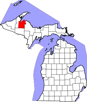 Map of Michigan highlighting Baraga County.svg | |
| Townships | ||
| Unincorporated communities | ||
| Indian reservations | ||
| Footnotes | ‡This populated place also has portions in an adjacent county or counties | |
| ||