Barkakana
Barkakana is a census town in Patratu (community development block) of Ramgarh district in the state of Jharkhand, India.
Barkakana
N.T.S Barkakana | |
|---|---|
Census Town | |
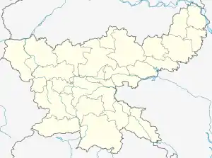
 Barkakana Location in Jharkhand, India  Barkakana Barkakana (India) | |
| Coordinates: 23.62°N 85.48°E | |
| Country | |
| State | Jharkhand |
| District | Ramgarh |
| Named for | Railway junction |
| Elevation | 377 m (1,237 ft) |
| Population (2011) | |
| • Total | 18,475 |
| Languages | |
| • Official | Hindi, Urdu Santhali |
| Time zone | UTC+5:30 (IST) |
| Telephone code | 06553 |
| Vehicle registration | JH |
| Website | ramgarh |
Geography
Barkakana is located at 23.62°N 85.48°E.[1] It has an average elevation of 377 m (1,237 ft).
Barkakana is a small township situated on the outskirts of the district town of Ramgarh Cantonment in Jharkhand. It is located in the Damodar rift valley with Hazaribagh plateau in the north and Ranchi plateau in the south, both of which are part of Chhotanagpur plateau. The town is surrounded by hills in south and has Ramgarh town in East. The river Damodar flows on its north.
Demographics
In the 2011 Census of India Barkakana had a population of 18,475. There were 9,640 males and 8,835 females. Scheduled castes numbered 2,465 and scheduled tribes numbered 3,842.[2]
Ramgarh Urban Agglomeration had a population of 132,441 in the 2011 Census, of which males were 70,871 and females 61,562.[3] Ramgarh Urban Agglomeration is composed of Ramgarh Cantonment (Cantonment Board), Sirka (Census Town), Marar (CT) and Barkakana (CT).[4]
As of 2001 India census,[5] Barkakana had a population of 16,872. Males constitute 54% of the population and females 46%. Barkakana has an average literacy rate of 68%. 13% of the population is under 6 years of age.
Literacy
In the 2011 census the total number of literates in Barkakana was 13,442 out of which 7,531 were males and 5,911 were females.[2]
In the 2011 census the total number of literates in Ramgarh UA was 95,734 (82.97 per cent of total population) out of which 55,352 (89.57 percent of males) were males and 40,362 (75.35 percent of females) were females.[3]
Economy
Barkakana serves as a marketplace and transit point for the people of nearby towns like Ramgarh, Kuju, and Bhurkunda, and villages including Teliyatu, Masmohna, Chotkakana and Piri. An important railway junction of East Central Railway is here with stoppage of all trains including Ranchi Rajdhani express. Several small-scale and medium-scale industries have come up in and around Barkakana, due to its proximity to the Damodar River, with easy and cheap availability of land and presence of good transportation facilities. It has administrative, operational control, maintenance and construction centres of Indian Railways under its traffic, civil engineering electrical engineering, mechanical engineering and signalling cadres. A repair shop of CCL is also present in this region.
Transport
Barkakana railway station is under Dhanbad division under East Central Railway zone of Indian Railways. The railway control room covering Barkakana section of Dhanbad division, covering 34 stations, is located here. It is also well-connected to the district town Ramgarh Cantonment via a four-lane road, which in turn is well-connected via a grid of national highways. Barkakana also houses a central repair shop of Central Coalfields Limited. A residential area for its employees is known as N.T.S. Barkakana.
Education
Barkakana has educational institutions only until the senior-secondary level. Prominent schools are DAV Public School, NTS Barkakana, and Kendriya Vidyalaya. Sri Narayan High School, R.A.M.school Barkakana, SVD Public School, and Saraswati Vidyamandir are others.
References
- Falling Rain Genomics, Inc - Barkakana
- "2011 Census C.D. Block Wise Primary Census Abstract Data(PCA)". Jharkhand – District-wise CD Blocks. Registrar General and Census Commissioner, India. Retrieved 15 November 2015.
- "Provisional population totals, Census of India 2011" (PDF). Urban Agglomeration – Cities having population 1 lakh and above. Government of India. Retrieved 14 December 2015.
- "Provisional population totals, Census of India 2011" (PDF). Constituents of Urban Agglomerations haing population above 1 lakh and above, Census 2011. Government of India. Retrieved 16 December 2015.
- "Census of India 2001: Data from the 2001 Census, including cities, villages and towns (Provisional)". Census Commission of India. Archived from the original on 16 June 2004. Retrieved 1 November 2008.