Baskatong Reservoir
The Baskatong Reservoir (French: Réservoir Baskatong) is a man-made lake in western Quebec, Canada. It was formed following the construction of the Mercier Dam in 1927[2] and has an area of 413 km2.[3] Since 2007, a 55 MW generating station is in operation at the site of the dam, the reservoir also being used to control the flow of the Gatineau River for several hydroelectric generating stations downstream.
| Baskatong Reservoir | |
|---|---|
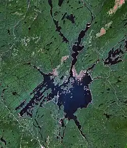 Highway 117 is visible in the lower left corner | |
 Baskatong Reservoir Location in Quebec | |
| Location | Antoine-Labelle Regional County Municipality / La Vallée-de-la-Gatineau Regional County Municipality, Quebec |
| Coordinates | 46°48′N 75°48′W |
| Type | Artificial |
| Primary inflows | Gatineau River |
| Primary outflows | Gatineau River |
| Basin countries | Canada |
| Max. length | 30 km (19 mi) |
| Max. width | 25 km (16 mi) |
| Surface area | 413 km2 (159 sq mi) |
| Max. depth | 96 m (315 ft) |
| Shore length1 | 2,800 km (1,700 mi) |
| Surface elevation | 207 m (679 ft) - 223 m (732 ft)[1] |
| Islands | over 160 |
| Settlements | Grand-Remous |
| References | [1] |
| 1 Shore length is not a well-defined measure. | |
Its primary source is the Gatineau River. Other significant sources are:
- Gens de Terre River
- Notawassi River (fr)
- Rivière d'Argent (fr)
Baskatong Reservoir is accessible by several short forest roads off Route 117, about 200 km (124 mi) north of Ottawa, and about 290 km (180 mi) north-west from Montreal.
Fish species
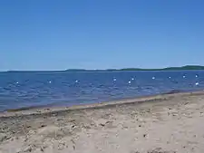
Baskatong Reservoir is a popular location for fishing and has over 20 outfitters established on its shores. Fish species present are walleye, northern pike, lake trout, whitefish, and landlocked salmon.[4]
See also
References
- Ottawa River Regulation Planning Board - Principal Reservoirs Current Water Levels and System Constraints Archived 2008-12-05 at the Wayback Machine
- Baskatong Reservoir - Communal Fauna Area Archived February 22, 2007, at the Wayback Machine
- Hydro-Québec - Baskatong Reservoir Archived September 27, 2007, at the Wayback Machine
- Baskatong outfitters association Archived April 26, 2007, at the Wayback Machine
External links
 Media related to Réservoir Baskatong at Wikimedia Commons
- Baskatong outfitters association
- Gatineau Valley Tourism site
| Provinces |
|
|---|---|
| Territories | |
| |