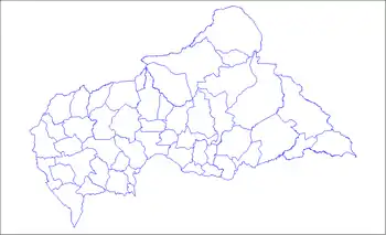
Bayanga
Bayanga is a sub-prefecture of Sangha-Mbaéré in the Central African Republic.[1][2]
Bayanga | |
|---|---|
| Country | |
Geography
Bayanga is located on the left bank of the Sangha River, about 102 km south of the capital of Nola Prefecture, and 520 km west of Bangui.
Population
The locality of Bayanga has about 4,000 inhabitants, the territory of the sub-prefecture 9,800 inhabitants in 2003.[3]
Environment
Bayanga is located in the tropical rainforest zone in the Dzanga-Sangha Dense Forest Special Reserve and 10 km from the Dzanga-Ndoki National Park.
History
Bayanga is originally a Sangha-Sangha fishing village, in the middle of the tropical rainforest populated by hunter-gatherers: the Baaka Pygmies .
In 1988, the Central African Government and WWF committed to the establishment and management of a protected area system in the region. This is the beginning of the Dzanga-Sangha Project (PDS). This will lead in 1990 to the creation of the Dzanga-Ndoki National Park (1150 km²) and the Dzanga-Sangha Dense Forest Special Reserve (3200 km²) for multiple use.
Civil war
On 10 March 2014 Bayanga subprefecture was captured by Anti-balaka militias following Seleka withdrawal.[4] It was recaptured by government forces forces in late May.[5]
Administration
Bayanga is with Nola in the north and Bambio in the east, one of the three sub-prefectures of the Sangha-Mbaéré . The commune of Yobe-Sangha is the only commune of the sub-prefecture .
Economy
With the creation of the Dzanga-Sangha Protected Area System (APDS) and the construction of a hotel in 1996, the foundations for the development of ecotourism activities capable of attracting an international clientele should be brought together. The locality has an airfield.
References
- "Bayanga". AccuWeather. Retrieved 5 June 2018.
- "Bayanga". Google Maps. Retrieved 5 June 2018.
- Recensement Général de la Population et de l'Habitat 2003
- "Ivory's Curse The Militarization & Professionalization of Poaching in Africa" (PDF). April 2014.
- "Elephant Watch". 4 May 2014.

