Bayville, New York
The Village of Bayville, sometimes referred to as Pine Island, is a village located on Long Island Sound facing Greenwich, Connecticut. The Incorporated Village of Bayville is located within the town of Oyster Bay in Nassau County, New York, United States. The population was 6,669 at the 2010 census.[3] The village was incorporated in 1919 during the incorporated village movement which allowed many larger estate owners on Long Island to establish political and security control over their domains.[4]
Bayville, New York | |
|---|---|
Village | |
| Incorporated Village of Bayville | |
| Nickname(s): Pine Island | |
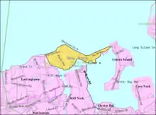
 Location in Nassau County and the state of New York. | |
 Location within the state of New York | |
| Coordinates: 40°54′26″N 73°33′26″W | |
| Country | |
| State | |
| County | Nassau |
| Government | |
| • Type | Board of Trustees |
| • Mayor | Robert E. De Natale (T) |
| • Board of Trustees | Members' List
|
| Area | |
| • Total | 1.55 sq mi (4.02 km2) |
| • Land | 1.46 sq mi (3.77 km2) |
| • Water | 0.10 sq mi (0.25 km2) |
| Elevation | 39 ft (12 m) |
| Population (2010) | |
| • Total | 6,669 |
| • Estimate (2019)[2] | 6,732 |
| • Density | 4,626.80/sq mi (1,785.81/km2) |
| Time zone | UTC-5 (Eastern (EST)) |
| • Summer (DST) | UTC-4 (EDT) |
| ZIP code | 11709 |
| Area code(s) | 516 |
| FIPS code | 36-05034 |
| GNIS feature ID | 0943216 |
| Website | bayvilleny |
History
Like many other Long Island communities, Bayville was first occupied by the Matinecock Indians and was known as Oak Neck and Pine Island. In 1658, Oyster Bay resident Daniel Whitehead purchased the land from the tribes. By 1745, the land was split among 23 men, and they mainly grew asparagus. In 1859, Oak Neck was renamed to Bayville and the first Methodist church was constructed west of what is now Merritt Lane. Multiple estates were built in the surrounding areas, and in 1898 a drawbridge was built, connecting Bayville and Mill Neck, another wealthy village on Long Island.[4][5]
In 1909, the Bayville Casino opened for business, attracting beachgoers, and in 1919, Winslow S. Pierce was elected the first mayor of the Village of Bayville. When the Arlington Hotel, Bayville Casino, and Ritzmore Estate burned to the ground, it prompted the creation of the Bayville Fire Department. Bayville was put on the front page of many newspapers in 1927 when the rum rummer William T. Bell ran ashore at the Oak Point estate. Things were a little slow for a while, but after World War II, things began to boom. A new church, post office, and school were built in the span of three years, and from 1950 to 1960, the population doubled.
In recent history, more rotaries and clubs were founded, and more parks were opened and dedicated. The village celebrated its centennial in the year 2019.
Geography
Bayville is located at 40°54′26″N 73°33′26″W (40.907277, −73.557131).[6]
According to the United States Census Bureau, the village has a total area of 1.5 square miles (3.9 km2), of which 1.4 square miles (3.6 km2) is land and 0.1 square miles (0.26 km2), or 3.42%, is water.
Demographics
| Historical population | |||
|---|---|---|---|
| Census | Pop. | %± | |
| 1930 | 1,042 | — | |
| 1940 | 1,516 | 45.5% | |
| 1950 | 1,981 | 30.7% | |
| 1960 | 3,962 | 100.0% | |
| 1970 | 6,147 | 55.1% | |
| 1980 | 7,034 | 14.4% | |
| 1990 | 7,193 | 2.3% | |
| 2000 | 7,135 | −0.8% | |
| 2010 | 6,669 | −6.5% | |
| 2019 (est.) | 6,732 | [2] | 0.9% |
| U.S. Decennial Census[7] | |||
As of the census[8] of 2000, there were 7,135 people, 2,566 households, and 1,906 families residing in the village. The population density was 5,065.7 people per square mile (1,953.8/km2). There were 2,683 housing units at an average density of 1,904.9 per square mile (734.7/km2). The racial makeup of the village was 96.01% White, 0.31% African American, 0.24% Native American, 1.64% Asian, 1.08% from other races, and 0.73% from two or more races. Hispanic or Latino of any race were 4.82% of the population.
There were 2,566 households, out of which 33.6% had children under the age of 18 living with them, 61.1% were married couples living together, 9.7% had a female householder with no husband present, and 25.7% were non-families. 20.6% of all households were made up of individuals, and 7.6% had someone living alone who was 65 years of age or older. The average household size was 2.74 and the average family size was 3.20.
In the village, the population was spread out, with 23.6% under the age of 18, 5.9% from 18 to 24, 29.6% from 25 to 44, 27.5% from 45 to 64, and 13.4% who were 65 years of age or older. The median age was 40 years. For every 100 females, there were 95.9 males. For every 100 females age 18 and over, there were 95.0 males.
The median income for a household in the village was $68,380, and the median income for a family was $77,838. Males had a median income of $50,969 versus $38,304 for females. The per capita income for the village was $33,665. About 2.7% of families and 4.7% of the population were below the poverty line, including 3.7% of those under age 18 and 8.3% of those age 65 or over.
Notable people
- Harrison Williams, 20th-Century entrepreneur, investor and multi-millionaire
- Jackie Martling, former writer for the Howard Stern Show
- Rick Pitino, former NBA and NCAA basketball coach
- Tommy Sheehan, contestant and winner of Survivor: Island of the Idols
References
- "2019 U.S. Gazetteer Files". United States Census Bureau. Retrieved July 27, 2020.
- "Population and Housing Unit Estimates". United States Census Bureau. May 24, 2020. Retrieved May 27, 2020.
- "Race, Hispanic or Latino, Age, and Housing Occupancy: 2010 Census Redistricting Data (Public Law 94-171) Summary File (QT-PL), Bayville village, New York". United States Census Bureau. Retrieved September 30, 2011.
- "Bayville Time Line". Archived from the original on 2011-05-17. Retrieved 2010-02-15.
- https://bayvilleny.gov/wp-content/uploads/2019/04/Bayville-Our-Home-2019.pdf
- "US Gazetteer files: 2010, 2000, and 1990". United States Census Bureau. 2011-02-12. Retrieved 2011-04-23.
- "Census of Population and Housing". Census.gov. Retrieved June 4, 2015.
- "U.S. Census website". United States Census Bureau. Retrieved 2008-01-31.
External links
Places adjacent to Bayville, New York | |
|---|---|
| Authority control |
|---|