Bear Brook (Ontario)
Bear Brook (French: ruisseau Bear) is a small stream in the municipalities of Clarence-Rockland and The Nation, United Counties of Prescott and Russell, and the city of Ottawa in eastern Ontario, Canada. It forms in the fields and forests just north of Edwards, and flows in a mostly eastern direction to its mouth as a left tributary of the South Nation River.[3][1][4][5][6]
| Bear Brook ruisseau Bear | |
|---|---|
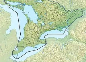 Location of the mouth of Bear Brook in Southern Ontario | |
| Location | |
| Country | Canada |
| Province | Ontario |
| County | Prescott and Russell |
| Municipalities | |
| Physical characteristics | |
| Source | Confluence of two unnamed streams |
| • location | Edwards |
| • coordinates | 45°20′54″N 75°27′49″W[1] |
| • elevation | 70 m (230 ft)[2] |
| Mouth | South Nation River |
• location | The Nation |
• coordinates | 45°25′11″N 75°04′13″W[3] |
• elevation | 48 m (157 ft)[2] |
| Basin features | |
| Progression | South Nation River→ Ottawa River→ Saint Lawrence River→ Gulf of Saint Lawrence |
| River system | Ottawa River drainage basin |
Communities along the brook include Edwards, Carlsbad Springs, Bearbrook, Cheney, and Bourget.
History
In the mid 19th century, the Bear Brook was used by loggers for floating timber to sawmills, a few of which operated in Carlsbad Springs from 1854 to 1905. It was also used by settlers for transportation to their homesteads. However the brook was too small and dry in the summer, and its use for transportation was quickly discontinued upon completion of Russell Road. All the surrounding mature forests have been logged, and consequently the brook drains faster.[7]
See also
References
- "Toporama (on-line map and search)". Atlas of Canada. Natural Resources Canada. Retrieved 2021-01-26.
- "Google Earth". Retrieved 2021-01-26.
- "Bear Brook". Geographical Names Data Base. Natural Resources Canada. Retrieved 2021-01-26.
- "Ontario Geonames GIS (on-line map and search)". Ontario Ministry of Natural Resources and Forestry. 2014. Retrieved 2021-01-26.
- Restructured municipalities - Ontario map #5 (Map). Restructuring Maps of Ontario. Ontario Ministry of Municipal Affairs and Housing. 2006. Retrieved 2021-01-26.
- Map 11 (PDF) (Map). 1 : 700,000. Official road map of Ontario. Ministry of Transportation of Ontario. 2020-01-01. Retrieved 2021-01-26.
- Gloucester Historical Society
External links
- Serré, Robert (2016). Glimpses of Cumberland Township: for the honour of our ancestors. Burnstown, Ontario: Burnstown Publishing House. ISBN 9781772570663. OCLC 973784683.
- Cumberland Township Historical Society