Beatty Point (Utah)
Beatty Point is a 7,780-foot (2,370 m) elevation summit located in the Kolob Canyons area of Zion National Park in Washington County, Utah, United States.[2]
| Beatty Point | |
|---|---|
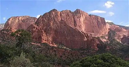
_(8423923437).jpg.webp) Southwest aspect | |
| Highest point | |
| Elevation | 7,780 ft (2,370 m) [1] |
| Prominence | 140 ft (43 m) [1] |
| Parent peak | Nagunt Mesa (7,785 ft)[1] |
| Isolation | 0.67 mi (1.08 km) [1] |
| Coordinates | 37°27′00″N 113°10′22″W [2] |
| Geography | |
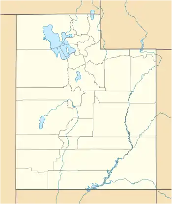 Beatty Point Location in Utah  Beatty Point Beatty Point (the United States) | |
| Location | Zion National Park Washington County, Utah, US |
| Parent range | Colorado Plateau |
| Topo map | USGS Kolob Arch |
| Geology | |
| Age of rock | Jurassic |
| Type of rock | Navajo sandstone |
| Climbing | |
| Easiest route | class 2 scrambling[1] |
Description
Paria Point is situated 0.5 mi (0.80 km) immediately north, and Nagunt Mesa is 0.57 mi (0.92 km) immediately south, with 2,000-foot-deep finger canyons between each.[3] Other neighbors include Timber Top Mountain 1.85 mi (2.98 km)to the south-southwest, and Tucupit Point to the north. Beatty Point is composed of Jurassic Navajo sandstone overlaying tilted Kayenta Formation. Precipitation runoff drains into Timber Creek and Taylor Creek, which are both part of the Virgin River drainage basin. This geographical feature's name honors the Beatty family of Toquerville, Utah.[4] Walter Lamb Beatty served as a guide for 20 years in Zion National Park.
Climate
Spring and fall are the most favorable seasons to visit Beatty Point. According to the Köppen climate classification system, it is located in a Cold semi-arid climate zone, which is defined by the coldest month having an average mean temperature below 32 °F (0 °C), and at least 50% of the total annual precipitation being received during the spring and summer. This desert climate receives less than 10 inches (250 millimeters) of annual rainfall, and snowfall is generally light during the winter.[5]

References
- "Beatty Point - 7,780' UT". listsofjohn.com. Retrieved 2020-10-21.
- U.S. Geological Survey Geographic Names Information System: Beatty Point
- "Beatty Point, Utah". Peakbagger.com.
- Ron Kay, Ron Kay's Guide to Zion National Park, Countryman Press, 2008, page 90.
- "Zion National Park, Utah, USA - Monthly weather forecast and Climate data". Weather Atlas. Archived from the original on August 31, 2020. Retrieved 31 August 2020.
External links
| Wikimedia Commons has media related to Beatty Point (Utah). |
- Zion National Park National Park Service
- Weather forecast: Beatty Point
- Beatty Point rock climbing: Mountainproject.com
- Walter Lamb Beatty: Findagrave.com