Bela Peč
Bela Peč (pronounced [ˈbeːla ˈpeːtʃ]) is a small dispersed settlement in the Municipality of Kamnik in the Upper Carniola region of Slovenia.
Bela Peč | |
|---|---|
 | |
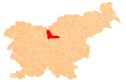
 Bela Peč Location in Slovenia | |
| Coordinates: 46°14′44.01″N 14°43′9.26″E | |
| Country | |
| Traditional region | Upper Carniola |
| Statistical region | Central Slovenia |
| Municipality | Kamnik |
| Elevation | 777.3 m (2,550.2 ft) |
| Population (2002) | |
| • Total | 26 |
| [1] | |
Name
The name Bela Peč means 'white cliff' and refers to Podbevšek Cliff (Podbevška peč, 1,190 meters or 3,900 feet), which rises at the north end of the settlement. Toponyms containing the common noun peč 'cliff' are common in Slovenia.[2] Other examples include the nearby villages of Sovinja Peč (literally, 'owl cliff') and Vranja Peč (literally, 'raven cliff').
Geography
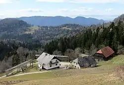
Bela Peč is a scattered village below Podbevšek Cliff, which rises above the Toman Pasture (Tomanova planina) to the north. The settlement consists of the hamlets and isolated farms of Osredkar, Podbevšek, Kočevo, and Šmonkar. There is road access to the village from the Tuhinj Valley via Snovik and Sela pri Kamniku. There are fields on the southern slopes below Podbevšek Cliff; they are steep and loamy, and difficult to cultivate.[3]
History
Because of the difficult agricultural conditions in the village, livestock breeding (cattle and especially sheep) dominated in the past. During the Second World War, the Partisans operated a courier station in the village to maintain connections between Upper Carniola and Styria. There was an engagement between the Partisans' Kamnik Company and German forces at the Osredkar farm in May 1942, and a Partisan hospital operated above the farm from March to October 1944. Water mains were installed in the village in 1968.[3]
References
- Statistical Office of the Republic of Slovenia
- Snoj, Marko (2009). Etimološki slovar slovenskih zemljepisnih imen. Ljubljana: Modrijan. p. 302.
- Savnik, Roman (1971). Krajevni leksikon Slovenije, vol. 2. Ljubljana: Državna založba Slovenije. p. 174.
External links
 Media related to Bela Peč at Wikimedia Commons
- Bela Peč at Geopedia