Bellampalle
Bellampalli is a town in Mancherial district of the Indian state of Telangana. It is a municipality and mandal headquarters of Bellampalli mandal of Bellampalli revenue division.[2]
Bellampalli | |
|---|---|
 Bellampalli Location in Telangana  Bellampalli Bellampalli (India) | |
| Coordinates: 19°4′32″N 79°29′17″E | |
| Country | India |
| State | Telangana |
| District | Mancherial |
| Government | |
| • Type | Municipality |
| Area | |
| • Total | 35.06 km2 (13.54 sq mi) |
| Population (2011)[2] | |
| • Total | 66,789 |
| • Rank | auto |
| • Density | 1,900/km2 (4,900/sq mi) |
| Demonym(s) | bellampallian |
| Time zone | UTC+5.30 (IST) |
| Lok Sabha constituency | peddapalli |
| Assembly constituency | Bellampalli |
| Website | Bellampalli Municipality - Shri.Godhumala Raju, Municipal commissioner |
History
It spelled as Bellampalli / Bellampalle / Bellampally Bellampalli is noted for its coal mines belonging to Singareni Collieries Company Limited. Bellampalli has the most coal mines and opencast mines in the state of Telangana. The first coal mine was established in 1936 by the British government. Later the town developed very rapidly with the discovery and excavation of many coal mines. The coal production from the SCCL is catering to the needs of the National Thermal Power Corporation, Ramagundam and many surrounding industrial buildings such as cement plants in Devapur, steel factory in Visakhapatnam and power plants in Maharashtra[3]
Demographics
As of 2011 India census,[4] Bellampalli had a population of 66,789. Males constitute 51% of the population and females 49%. Bellampalli has an average literacy rate of 65.65%, higher than the national average of 59.5%, with 57% of the males and 43% of females literate. 11% of the population is under 6 years of age.
Government and politics
Civic administration
Bellampalle Municipality was constituted in 1987 and is classified as a second grade municipality with 23 election wards. The jurisdiction of the civic body is spread over an area of 35.06 km2 (13.54 sq mi).[1]
Politics
Bellampalli has been a traditional stronghold and birthplace of the CPI, also known as the Communist Party of India. CPI leader Gunda Mallesh won the MLA seat for Bellampally in the 2009 elections. Gunda Mallesh is a senior politician from Bellampally and the CPI. The former MLA's of this of constituency are Amurajula Sreedevi and Pati Subadra. Bellampalli assembly constituency comes under Peddapalli Lok Sabha constituency. Suman Balka is present MP and he is a student of osmania university, Youth Wing President is Sahith Sharma.
- MLA's of Bellampalli
- Sridevi (TDP)-2004
- Gunda Mallesh (CPI) -2009
- Durgam Chinnaih (TRS) -2014
Administravtive Division
There are 13 Villages under Bellampalli.[5]
| Sl.No. | Name of the Mandal | Villages in the Mandal | Name of the Erstwhile Mandals from which the present Mandal is formed |
| 1 | Bellampalli | Bellampalle | Bellampalli |
| 2 | Ankusam | ||
| 3 | Kannal (R) | ||
| 4 | Chakepalle | ||
| 5 | Budha Khurd (R) | ||
| 6 | Budha Kalan (R) | ||
| 7 | Chandravelli | ||
| 8 | Rangapet | ||
| 9 | Dugnepalle | ||
| 10 | Gurjal (R) @ Talla Gurjal | ||
| 11 | Akenipalle | ||
| 12 | Batwanpalle | ||
| 13 | Perkapalle |
Economy
Coal production has been very important to the economic history of Bellampalli and it is thus known as an industrial town.[6] A chemicals and fertilizer factory also lies in the town. However, the average income of Rs. 5000/- per capita according to 1989 figures mean that the average person is living in poverty.[7]
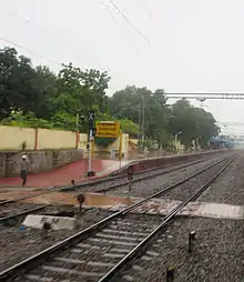
Transport
Bellampalli is well connected by road and train.
Bellampally railway station is one of the most oldest railway stations in Telangana region and it lies in Nagpur–Hyderabad line.
Bellampalli comes under south central railway and its 273 km distance towards North (Delhi route) from Hyderabad (Capital of the state)
Railway code: BPA
References
- "Urban Local Body Information" (PDF). Directorate of Town and Country Planning. Government of Telangana. Archived from the original (PDF) on 15 June 2016. Retrieved 28 June 2016.
- "District Census Handbook – Adilabad" (PDF). Census of India. The Registrar General & Census Commissioner. pp. 13, 214. Retrieved 13 May 2016.
- TelanganaPradesh (India). Bureau of Economics and Statistics (1987). Statistical abstract of Andhra Pradesh. Bureau of Economics and Statistics. Retrieved 22 March 2012.
- "Census of India 2001: Data from the 2001 Census, including cities, villages and towns (Provisional)". Census Commission of India. Archived from the original on 16 June 2004. Retrieved 1 November 2008.
- "Schedule - II Reorganization Of Mandals In Mancherial District". www.districtsinfo.com. Retrieved 10 March 2017.
- India. Office of the Registrar General (1967). Census of India, 1961: Andhra Pradesh. Manager of Publications. p. 78. Retrieved 22 March 2012.
- Rao, Vidyananda Mohan; Aziz, Abdul; Rao, Vijendra Kasturi Ranga Varadaraja (1989). Poverty alleviation in India: programmes and action. Ashish Pub. House. pp. 42–3. ISBN 978-81-7024-255-0. Retrieved 22 March 2012.