Belvidere Township, Michigan
Belvidere Township is a civil township of Montcalm County in the U.S. state of Michigan. As of the 2000 census, the township population was 2,438.
Belvidere Township, Michigan | |
|---|---|
 Belvidere Township, Michigan Location within the state of Michigan  Belvidere Township, Michigan Belvidere Township, Michigan (the United States) | |
| Coordinates: 43°25′46″N 85°8′54″W | |
| Country | United States |
| State | Michigan |
| County | Montcalm |
| Organized | March 7, 1867 |
| Area | |
| • Total | 36.1 sq mi (93.4 km2) |
| • Land | 34.8 sq mi (90.2 km2) |
| • Water | 1.2 sq mi (3.2 km2) |
| Elevation | 915 ft (279 m) |
| Population (2000) | |
| • Total | 2,438 |
| • Density | 70.0/sq mi (27.0/km2) |
| Time zone | UTC-5 (Eastern (EST)) |
| • Summer (DST) | UTC-4 (EDT) |
| ZIP codes | |
| FIPS code | 26-07200[1] |
| GNIS feature ID | 1625911[2] |
Communities
- Six Lakes is an unincorporated community near the center of the township at 43°25′30″N 85°09′00″W[3] on M-46 where M-66 branches to the north. A settlement named "Sumnerville" laid out by L. C. Sumner in 1873 and located approximately one-and-a-half-mile (2.4 km) east of Six Lakes was the first village platted in the township. The settlement saw some growth, but when the Chicago, Saginaw and Canada Railroad (which became part of the Pere Marquette Railway and then the Chesapeake and Ohio Railway) was built and a station was established nearer to the Flat River, Sumner subsequently sold his holdings and moved to Edmore. Hiram Clark and Dr. J. B. Daniels purchased 70 acres (280,000 m2) of land around the rail station, then platted "Six Lakes" on May 13, 1876. A post office was established on December 20, 1878.[4] [5] [6] [7] The Six Lakes post office with ZIP code 48886 serves most of Belvidere Township as well as smaller portions of Cato Township to the west, Douglass Township to the south and Millbrook Township to the north in Mecosta County.[8]
- The village of Edmore is to the east in Home Township and the Edmore ZIP code 48829 also serves portions of eastern Belvidere Township.[9]
- The village of Lakeview is to the west in Cato Township and the Lakeview ZIP code 48850 also serves portions of northwest Belvidere Township.[10]
- The city of Stanton is to the south and the Stanton ZIP code 48888 also serves a portion of southern Belvidere Township.[11]
Geography
According to the United States Census Bureau, the township has a total area of 36.1 square miles (93 km2), of which 34.8 square miles (90 km2) is land and 1.2 square miles (3.1 km2) (3.38%) is water.
Demographics
As of the census[1] of 2000, there were 2,438 people, 952 households, and 699 families residing in the township. The population density was 70.0 per square mile (27.0/km2). There were 1,324 housing units at an average density of 38.0 per square mile (14.7/km2). The racial makeup of the township was 95.94% White, 0.37% African American, 1.97% Native American, 0.12% Asian, 0.25% from other races, and 1.35% from two or more races. Hispanic or Latino of any race were 1.35% of the population.
There were 952 households, out of which 32.1% had children under the age of 18 living with them, 58.9% were married couples living together, 8.5% had a female householder with no husband present, and 26.5% were non-families. 21.7% of all households were made up of individuals, and 9.8% had someone living alone who was 65 years of age or older. The average household size was 2.55 and the average family size was 2.93.
In the township the population was spread out, with 25.8% under the age of 18, 7.6% from 18 to 24, 25.9% from 25 to 44, 24.7% from 45 to 64, and 16.1% who were 65 years of age or older. The median age was 38 years. For every 100 females, there were 96.9 males. For every 100 females age 18 and over, there were 96.5 males.
The median income for a household in the township was $33,477, and the median income for a family was $37,717. Males had a median income of $33,750 versus $20,893 for females. The per capita income for the township was $15,920. About 7.4% of families and 10.6% of the population were below the poverty line, including 14.1% of those under age 18 and 10.2% of those age 65 or over.
References
- "U.S. Census website". United States Census Bureau. Retrieved 2008-01-31.
- U.S. Geological Survey Geographic Names Information System: Belvidere Township, Michigan
- U.S. Geological Survey Geographic Names Information System: Six Lakes, Michigan
- Romig, Walter (1986) [1973]. Michigan Place Names. Detroit, Michigan: Wayne State University Press. ISBN 0-8143-1838-X.
- Six Lakes Station Archived 2007-11-06 at the Wayback Machine, Michigan's Internet Railroad History Museum
- Schenck, John S. (2005) [1881]. "Belvidere". History of Ionia and Montcalm counties, Michigan. Ann Arbor, Mich.: University of Michigan Library. pp. 404–405. Retrieved 2009-02-15.
- Dasef, John W. (2005) [1916]. "Township History". History of Montcalm County, Michigan its people, industries and institutions...with biographical sketches of representative citizens and genealogical records of many of the old families. Ann Arbor, Mich.: University of Michigan Library. pp. 60–65. Retrieved 2009-02-06.
- ZCTA Reference Map for 48886 Archived 2020-02-12 at Archive.today, U.S. Census Bureau, 2000 census
- ZCTA Reference Map for 48829 Archived 2020-02-12 at Archive.today, U.S. Census Bureau, 2000 census
- ZCTA Reference Map for 48850 Archived 2020-02-12 at Archive.today, U.S. Census Bureau, 2000 census
- ZCTA Reference Map for 48888 Archived 2020-02-12 at Archive.today, U.S. Census Bureau, 2000 census
Municipalities and communities of Montcalm County, Michigan, United States | ||
|---|---|---|
| Cities | 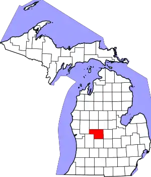 Map of Michigan highlighting Montcalm County | |
| Villages | ||
| Charter township | ||
| General law townships | ||
| ||