Bereznehuvate Raion
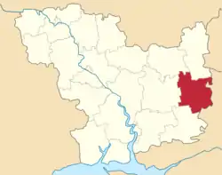
Bereznehuvate Raion (Ukrainian: Березнегуватський район) was a subdivision of Mykolaiv Oblast of Ukraine. Its administrative center was the urban-type settlement of Bereznehuvate. The raion was abolished on 18 July 2020 as part of the administrative reform of Ukraine, which reduced the number of raions of Mykolaiv Oblast to four.[2][3] The last estimate of the raion population was 19,344 (2020 est.)[1]
Bereznehuvatskyi Raion
Березнегуватський район | |
|---|---|
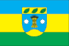 Flag 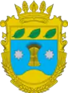 Coat of arms | |
 | |
| Coordinates: 47°20′49″N 32°52′38″E | |
| Country | |
| Region | Mykolaiv Oblast |
| Established | 1923 |
| Disestablished | 18 July 2020 |
| Admin. center | Bereznehuvate |
| Subdivisions | List
|
| Government | |
| • Governor | Anatoliy Kruts |
| Area | |
| • Total | 1,263 km2 (488 sq mi) |
| Population (2020) | |
| • Total | |
| Time zone | UTC+02:00 (EET) |
| • Summer (DST) | UTC+03:00 (EEST) |
| Postal index | 56200—56254 |
| Area code | +380 5168 |
History
Administratively, since 1776 the area belonged to Khersonsky Uyezd, which was shuffled between different governorates of the Russian Empire: Yekaterinoslav Viceroyalty until 1795, Voznesensk Viceroyalty until 1796, Novorossiya Governorate until 1803, Kherson Governorate until 1920,[4] Nikolayev Governorate until 1921, and Odessa Governorate until 1923, when uyezds were abolished in the Ukrainian Soviet Socialist Republic; the governorates were divided into okruhas. In 1923, Bereznehuvate Raion of Kherson Okruha, with the administrative center in Bereznehuvate, was established.[5] In 1925, the governorates were abolished, and okruhas were directly subordinated to Ukrainian SSR. In 1930, okruhas were abolished. In 1935, Bereznehuvate Raion was transferred into Odessa Oblast.[6] On 22 September 1937, Mykolaiv Oblast was established on lands which previously belonged to Dnipropetrovsk and Odessa Oblasts, and Bereznehuvate Raion became part of newly created Mykolaiv Oblast.[7]
In March and April 1944, Bereznegovatoye–Snigirevka Offensive, a part of major Dnieper–Carpathian Offensive of the Soviet army during the last phase of World War II, took place around Bereznehuvate.
References
- "Чисельність наявного населення України (Actual population of Ukraine)" (PDF) (in Ukrainian). State Statistics Service of Ukraine. Retrieved 30 September 2020.
- "Про утворення та ліквідацію районів. Постанова Верховної Ради України № 807-ІХ". Голос України (in Ukrainian). 2020-07-18. Retrieved 2020-10-03.
- "Нові райони: карти + склад" (in Ukrainian). Міністерство розвитку громад та територій України.
- "Березнеговатое в XVIII-XX веках: история Николаевщины" (in Russian). Николаевские Известия. 12 December 2015. Retrieved 5 March 2016.
- Вся Одещина. Odessa: Odessa Okruha. 1926. p. 410.
- "Становление и развитие" (in Russian). Одесские известия. Archived from the original on 13 March 2016. Retrieved 12 March 2016.
- "Районы Николаевской области" (in Russian). Николаевская область. Электронная историческая энциклопедия. Retrieved 6 March 2016.
| Raions | |||||
|---|---|---|---|---|---|
| Hromadas | |||||
| Cities |
| ||||
| |||||
