Bernice, Oklahoma
Bernice is a town in Delaware County, Oklahoma, United States. The population was 562 at the 2010 census, an increase of 11.5 percent over the figure of 504 recorded in 2000.[5] The town is now primarily a vacation and retirement area. It claims to be the "Crappie Fishing Capital of the World."[6]
Bernice, Oklahoma | |
|---|---|
| Motto(s): "Crappie fishing capital of the world" | |
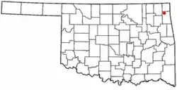
 Location of Bernice, Oklahoma | |
| Coordinates: 36°37′31″N 94°54′49″W | |
| Country | United States |
| State | Oklahoma |
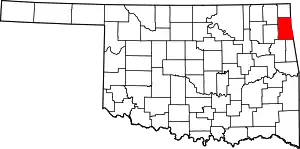
| County | Delaware |
| Area | |
| • Total | 1.45 sq mi (3.77 km2) |
| • Land | 0.86 sq mi (2.24 km2) |
| • Water | 0.59 sq mi (1.53 km2) |
| Elevation | 761 ft (232 m) |
| Population (2010) | |
| • Total | 562 |
| • Estimate (2019)[2] | 580 |
| • Density | 671.30/sq mi (259.11/km2) |
| Time zone | UTC-6 (Central (CST)) |
| • Summer (DST) | UTC-5 (CDT) |
| FIPS code | 40-05550[3] |
| GNIS feature ID | 1090016[4] |
History
Bernice was founded in 1912, after Rose Mode and his partner, Charles Lee, bought 60 acres (24 ha) of land in the Horse Creek Basin of northwestern Delaware County. The town was named for Mode's daughter, Bernice. A post office was established on February 12, 1913, and the town soon become a local agricultural center. By 1918, Bernice had an estimated population on nearly 400 people. Businesses included a bank, a milliner, a grain elevator, a sawmill, a hotel, a flour mill and three general stores. The population declined after World War I and the Great Depression from 198 in 1920 to 162 in 1930, and 91 in 1940. After World War II, population growth rebounded to 318 in 1980.[6]
Construction of Pensacola Dam and Grand Lake o' the Cherokees put the original town in a flood plain, so the residents moved to high ground outside the proposed lake.[6]
At present, the town serves as a vacation spot for many residents of surrounding communities. Indian Hills Resort, the oldest recreational business in the town, was established in 1940. Bernice State Park, approximately one-half mile east of town, across the Neosho River, also attracts vacationers.[6]
Geography
Bernice is located along the west bank of Horse Creek,[6] at 36°37′31″N 94°54′49″W (36.625286, -94.913643).[7]
According to the United States Census Bureau, the town has a total area of 1.5 square miles (3.9 km2), of which 0.9 square miles (2.3 km2) is land and 0.6 square miles (1.6 km2) (38.62%) is water.
Demographics
| Historical population | |||
|---|---|---|---|
| Census | Pop. | %± | |
| 1920 | 198 | — | |
| 1930 | 162 | −18.2% | |
| 1940 | 205 | 26.5% | |
| 1950 | 91 | −55.6% | |
| 1960 | 100 | 9.9% | |
| 1970 | 189 | 89.0% | |
| 1980 | 318 | 68.3% | |
| 1990 | 330 | 3.8% | |
| 2000 | 504 | 52.7% | |
| 2010 | 562 | 11.5% | |
| 2019 (est.) | 580 | [2] | 3.2% |
| U.S. Decennial Census[8] | |||
As of the census[3] of 2000, there were 504 people, 245 households, and 152 families residing in the town. The population density was 565.0 people per square mile (218.6/km2). There were 385 housing units at an average density of 431.6 per square mile (167.0/km2). The racial makeup of the town was 81.35% White, 12.90% Native American, and 5.75% from two or more races. Hispanic or Latino of any race were 1.19% of the population.
There were 245 households, out of which 20.0% had children under the age of 18 living with them, 55.5% were married couples living together, 3.3% had a female householder with no husband present, and 37.6% were non-families. 35.5% of all households were made up of individuals, and 15.5% had someone living alone who was 65 years of age or older. The average household size was 2.06 and the average family size was 2.59.
In the town, the population was spread out, with 16.7% under the age of 18, 6.3% from 18 to 24, 20.8% from 25 to 44, 31.3% from 45 to 64, and 24.8% who were 65 years of age or older. The median age was 51 years. For every 100 females, there were 104.9 males. For every 100 females age 18 and over, there were 102.9 males.
The median income for a household in the town was $24,844, and the median income for a family was $30,288. Males had a median income of $24,444 versus $15,833 for females. The per capita income for the town was $15,005. About 9.5% of families and 14.1% of the population were below the poverty line, including 24.4% of those under age 18 and 13.2% of those age 65 or over.
References
- "2019 U.S. Gazetteer Files". United States Census Bureau. Retrieved July 28, 2020.
- "Population and Housing Unit Estimates". United States Census Bureau. May 24, 2020. Retrieved May 27, 2020.
- "U.S. Census website". United States Census Bureau. Retrieved 2008-01-31.
- "US Board on Geographic Names". United States Geological Survey. 2007-10-25. Retrieved 2008-01-31.
- CnsusViewer: Population of the City of Bernice, Oklahoma
- Sharon Koons, "Bernice." Encyclopedia of Oklahoma History and Culture. Accessed July 19, 2012.
- "US Gazetteer files: 2010, 2000, and 1990". United States Census Bureau. 2011-02-12. Retrieved 2011-04-23.
- "Census of Population and Housing". Census.gov. Retrieved June 4, 2015.
