Bethanie, North West
Bethanie is a town in Bojanala District Municipality in the North West province of South Africa.
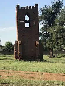
The Bell tower in Bethanie is one of the oldest structures in the village. It was constructed in the late 1800s as part of the Mission.
Bethanie | |
|---|---|
 Bethanie  Bethanie | |
| Coordinates: 25.554°S 27.606°E | |
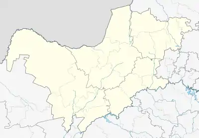
| Country | South Africa |
| Province | North West |
| District | Bojanala |
| Municipality | Rustenburg |
| Government | |
| • Councillor | Chief Mamogale |
| Area | |
| • Total | 27.87 km2 (10.76 sq mi) |
| Population (2011)[1] | |
| • Total | 8,429 |
| • Density | 300/km2 (780/sq mi) |
| Racial makeup (2011) | |
| • Black African | 99.1% |
| • Coloured | 0.1% |
| • Indian/Asian | 0.4% |
| • White | 0.1% |
| • Other | 0.3% |
| First languages (2011) | |
| • Tswana | 79.2% |
| • Zulu | 5.2% |
| • English | 4.8% |
| • Tsonga | 2.1% |
| • Other | 8.7% |
| Time zone | UTC+2 (SAST) |
| Postal code (street) | 0260 |
| PO box | 0270 |
| Area code | 012 |
tation of the Hermannsburg Mission 37 km north-east of Rustenburg, established in 1864. Of biblical origin (Matt. 26:6 and Mark 14:3; 11:1), the name is Hebrew for 'house of sorrow or misery'.[2]
Bethanie is the capital town of Bakwena Ba Mogopa, a SeTswana speaking traditional community. It is part of 15 villages that form part of the Bakwena Ba Mogopa nation. The village was previously a farm called Losperfontein, owned by Tjaart Kruger, President Paul Kruger's younger brother. The community with the assistance of the missionary, Wilhelm Behrens sen, purchased the farm around 1866, which led to it being renamed Bethanie.
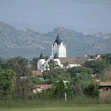
A view of Bethanie, with the iconic Lutheran Church a centerpiece.
|
|---|
- "Main Place Bethanie". Census 2011.
- Raper, Peter E. (1987). Dictionary of Southern African Place Names. Internet Archive. p. 76. Retrieved 28 August 2013.
Municipalities and communities of Bojanala Platinum District Municipality, North West | ||
|---|---|---|
District seat: Rustenburg | ||
| Moretele | .svg.png.webp) Bojanala Platinum District within South Africa | |
| Madibeng | ||
| Rustenburg | ||
| Kgetlengrivier | ||
| Moses Kotane | ||
This article is issued from Wikipedia. The text is licensed under Creative Commons - Attribution - Sharealike. Additional terms may apply for the media files.