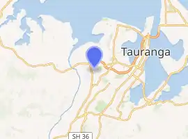
Bethlehem, New Zealand
Bethlehem is a suburb of Tauranga in New Zealand's North Island. Originally a small independent town, it has now been absorbed by Tauranga and comprises a number of subdivisions including Bethlehem Heights, Sterling Gate, La Cumbre, Saint Andrews, and Mayfield.[2]
Bethlehem | |
|---|---|
Suburb | |
| |
| Country | New Zealand |
| Local authority | Tauranga |
| Electoral ward | Otumoetai/Pyes Pa |
| Population (2018)[1] | |
| • Total | 8,634 |
| (Tauranga Harbour) | Bellevue | |
| Te Puna |
|
Judea |
| Tauriko | Gate Pa |
It is situated on State Highway 2, and has amenities such as the Bethlehem Town Centre shopping centre.
Demographics
| Year | Pop. | ±% p.a. |
|---|---|---|
| 2006 | 5,556 | — |
| 2013 | 7,050 | +3.46% |
| 2018 | 8,634 | +4.14% |
| Source: [1] | ||
Bethlehem North, comprising the statistical areas of Bethlehem North, Bethlehem Central and Bethlehem South, had a population of 8,634 at the 2018 New Zealand census, an increase of 1,584 people (22.5%) since the 2013 census, and an increase of 3,078 people (55.4%) since the 2006 census. There were 3,228 households. There were 4,044 males and 4,593 females, giving a sex ratio of 0.88 males per female, with 1,473 people (17.1%) aged under 15 years, 1,068 (12.4%) aged 15 to 29, 3,369 (39.0%) aged 30 to 64, and 2,724 (31.5%) aged 65 or older.
Ethnicities were 85.8% European/Pākehā, 10.8% Māori, 1.5% Pacific peoples, 8.3% Asian, and 1.3% other ethnicities (totals add to more than 100% since people could identify with multiple ethnicities).
The proportion of people born overseas was 24.7%, compared with 27.1% nationally.
Although some people objected to giving their religion, 40.2% had no religion, 49.0% were Christian, 0.7% were Hindu, 0.2% were Muslim, 0.7% were Buddhist and 2.7% had other religions.
Of those at least 15 years old, 1,569 (21.9%) people had a bachelor or higher degree, and 1,206 (16.8%) people had no formal qualifications. The employment status of those at least 15 was that 2,694 (37.6%) people were employed full-time, 1,053 (14.7%) were part-time, and 177 (2.5%) were unemployed.[1]
| Name | Population | Median age | Median income |
|---|---|---|---|
| Bethlehem North | 3,429 | 58.1 years | $28,100 |
| Bethlehem Central | 4,119 | 48.4 years | $33,300 |
| Bethlehem South | 1,086 | 44.9 years | $41,800 |
| New Zealand | 37.4 years | $31,800 |
Marae
Bethlehem has two Ngāti Ranginui marae:
- Hangarau or Peterehema Marae and its Hangarau is affiliated with Ngāti Hangarau.
- Te Wairoa Marae and its Kahu Tapu meeting house are affiliated with Ngāti Kahu, Ngāti Pango and Ngāti Rangi.[3][4]
Economy
Bethlehem Town Centre
Bethlehem Town Centre is a shopping area covering 20,000 m².[5] It has 1000 carparks and about 50 retailers, including Kmart, Countdown and Smiths City.[6]
Education
Bethlehem Campus
The local Bethlehem Campus includes several Christian educational institutions on a single site.
Bethlehem College is a co-educational state-integrated school for Year 1 to 13 students.[7][8] with a roll of 1813 as of March 2020.[9]
In January 2013 a van of Bethlehem College students and former students crashed in a small village in Kenya, while they were on a volunteer mission at Ark Quest Academy.[10] Student Caitlin Dickson was killed, as were married couple Brian and Grace Johnston. Kenyan bus driver Christopher Mmata was also killed.[11]
Bethlehem Tertiary Institute, formerly the Bethlehem Institute of Education, is a tertiary institution offering Degrees and Diplomas in teaching, social work and counselling and a Master of Professional Practice. Over 400 students are enrolled and students may study either onsite with a 'flipped classroom' approach or through innovative distance learning. The academy was founded in 1988 as a primary school with 100 students, and has expanded since to offer secondary and tertiary education.[12]
Other schools
Bethlehem has three other schools.
Bethlehem School is a co-educational state primary school,[13] with a roll of 487.[14]
Tauranga Adventist School is a co-educational state-integrated Seventh-day Adventist primary school,[15][16] with a roll of 113.[17]
Te Wharekura o Mauao is a co-educational state secondary school,[18][19] with a roll of 248.[20]
References
- "Statistical area 1 dataset for 2018 Census". Statistics New Zealand. March 2020. Bethlehem North (193000), Bethlehem Central (193500) and Bethlehem South (194200). 2018 Census place summary: Bethlehem North 2018 Census place summary: Bethlehem Central 2018 Census place summary: Bethlehem South
- "Place name detail: Bethlehem". New Zealand Gazetteer. New Zealand Geographic Board.
- "Te Kāhui Māngai directory". tkm.govt.nz. Te Puni Kōkiri.
- "Māori Maps". maorimaps.com. Te Potiki National Trust.
- "Bethlehem's Kmart opening marks end of big project". New Zealand Media and Entertainment. New Zealand Herald. 18 March 2016.
- "Store Directory - Bethlehem Town Centre". shopbethlehem.co.nz. Colliers International.
- "Bethlehem College Official School Website". beth.school.nz.
- "Bethlehem College Ministry of Education School Profile". educationcounts.govt.nz. Ministry of Education.
- "Bethlehem College Education Review Office Report". ero.govt.nz. Education Review Office.
- "Community shocked by Kenya crash deaths". 3 News NZ. 16 January 2013. Archived from the original on 21 January 2013. Retrieved 17 January 2013.
- "Kenya crash survivors recovering well". 3 News NZ. 18 January 2013. Archived from the original on 12 April 2013. Retrieved 17 January 2013.
- "Bethlehem Tertiary Institute". bti.ac.nz. Bethlehem Tertiary Institute.
- "Bethlehem School Ministry of Education School Profile". educationcounts.govt.nz. Ministry of Education.
- "Bethlehem School Education Review Office Report". ero.govt.nz. Education Review Office.
- "Tauranga Adventist School Official School Website". taurangasda.school.nz.
- "Tauranga Adventist School Ministry of Education School Profile". educationcounts.govt.nz. Ministry of Education.
- "Tauranga Adventist School Education Review Office Report". ero.govt.nz. Education Review Office.
- "Te Wharekura o Mauao Official School Website". mauao.school.nz.
- "Te Wharekura o Mauao Ministry of Education School Profile". educationcounts.govt.nz. Ministry of Education.
- "Te Wharekura o Mauao Education Review Office Report". ero.govt.nz. Education Review Office.