Bhitarwar
Bhitarwar is a city and a nagar palika in Gwalior district in the state of Madhya Pradesh, India. The town is surrounded by a river called Parbati.
Bhitarwar | |
|---|---|
city | |
| Nickname(s): Goleswar mahadev ki nagari | |
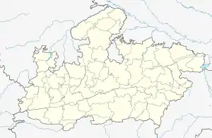
 Bhitarwar Location in Madhya Pradesh, India  Bhitarwar Bhitarwar (India) | |
| Coordinates: 25.8°N 78.12°E | |
| Country | India |
| State | Madhya Pradesh |
| District | Gwalior |
| bhitravar | 1706 |
| Founded by | raja rao bahoran |
| Named for | fort |
| Government | |
| • Type | municipality |
| • Body | vidhansabha |
| Area | |
| • Total | 23.9 km2 (9.2 sq mi) |
| Area rank | 3rd in district |
| Elevation | 199 m (653 ft) |
| Population (2011) | |
| • Total | 25,670 |
| • Rank | 3rd in district |
| • Density | 1,100/km2 (2,800/sq mi) |
| Languages | |
| • Official | Hindi |
| Time zone | UTC+5:30 (IST) |
| PIN | 475220 |
| Vehicle registration | MP07 |
| Website | www.npbhitarwar.com |
Geography
Bhitarwar is located at 25.8°N 78.12°E.[1] It has an average elevation of 227 metres (745 feet).[2]
Demographics
As of 2017 India census,[3] Bhitarwar had a population of 25,670. Males constitute 54% of the population and females 46%. Bhitarwar has an average literacy rate of 74%, higher than the national average of 59.5%; with male literacy of 82% and female literacy of 64%. 17% of the population is under 6 years of age.
Transportation
Bhitarwar is situated on Dabra - satanwada state highway and connected to all nearby cities by road. Nearest railway station is in Dabra, and major railway junction is Gwalior which is around 72 km away from the town and jhansi 75 km . Nearest airport is Rajmata vijyaraje scindia airport.
Economy
Economy of the city is based on agriculture. The main crop of this area is wheat, rice and sugarcane, there is a sugar factory in this city.
Tourist attractions
There is many places of interest in the town like Dhumeswar , Lakheswari and Diyadah. Around 15 km away is an ancient city called Padma Pavaya. Goleswar temple is another place for visit in the city. There is a small fort in the old bhitarwar city which has need to be restoration. Some parks are also build by the govt in the town are lakhmibai park, laxamangarh park Harsi dam etc.
References
- Falling Rain Genomics, Inc - Bhitarwar
- "Bhitarwar, Madhya Pradesh, India". latlong.net. Retrieved 26 December 2018.
- "Census of India 2001: Data from the 2001 Census, including cities, villages and towns (Provisional)". Census Commission of India. Archived from the original on 16 June 2004. Retrieved 1 November 2008.
- "Bhitarwar Religion Census 2011". Census 2011 India. Missing or empty
|url=(help)
