Bieżanów-Prokocim
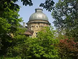
Bieżanów-Prokocim is one of 18 districts of Kraków, located in the southeast part of the city. The name Bieżanów-Prokocim comes from two villages that are now parts of the district.
Bieżanów-Prokocim | |
|---|---|
 | |
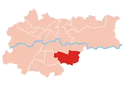 Location of Bieżanów-Prokocim within Kraków | |
| Coordinates: 50°0′58.78″N 20°1′52.18″E | |
| Country | |
| Voivodeship | Lesser Poland |
| County/City | Kraków |
| Government | |
| • President | Zbigniew Kożuch |
| Area | |
| • Total | 18.47 km2 (7.13 sq mi) |
| Population (2014) | |
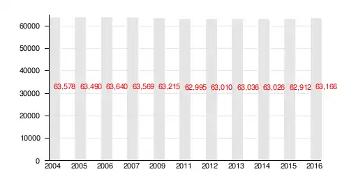
| • Total | 63,026 |
| • Density | 3,400/km2 (8,800/sq mi) |
| Time zone | UTC+1 (CET) |
| • Summer (DST) | UTC+2 (CEST) |
| Area code(s) | +48 12 |
| Website | http://www.dzielnica12.krakow.pl |
According to the Central Statistical Office data, the district's area is 18.47 square kilometres (7.13 square miles) and 63 026 people inhabit Bieżanów-Prokocim.[1]
Subdivisions of Bieżanów-Prokocim
Bieżanów-Prokocim is divided into smaller subdivisions (osiedles). Here's a list of them.
- Bieżanów
- Bieżanów Kolonia
- Kaim
- Łazy
- Osiedle Kolejowe
- Osiedle Medyków
- Osiedle Na Kozłówce
- Osiedle Nad Potokiem
- Osiedle Nowy Bieżanów
- Osiedle Nowy Prokocim
- Osiedle Parkowe
- Osiedle Złocień
- Prokocim
- Rżąka
Population
References
- "Information about Bieżanów-Prokocim district". Biuletyn Informacji Publicznej. Retrieved 30 August 2017.
External links
| Wikimedia Commons has media related to District XII Bieżanów-Prokocim (Kraków). |
This article is issued from Wikipedia. The text is licensed under Creative Commons - Attribution - Sharealike. Additional terms may apply for the media files.