Bisbee Group
The Bisbee Group is a geologic group in Arizona,[1] Mexico, and New Mexico.[2] It preserves fossils dating back to the early Cretaceous period.[3]
| Bisbee Group Stratigraphic range: early Cretaceous | |
|---|---|
| Type | Group |
| Sub-units | Glance Conglomerate, Morita Formation, Mural Limestone, Cintura Formation |
| Underlies | Bronco Volcanics |
| Overlies | Naco Formation |
| Thickness | Over 21,000 feet (6,400 m) |
| Lithology | |
| Primary | Sandstone, claystone, limestone |
| Other | Conglomerate |
| Location | |
| Coordinates | 31.42°N 109.95°W |
| Region | Arizona New Mexico Chihuahua |
| Country | United States Mexico |
| Type section | |
| Named by | E.T. Dumble |
| Year defined | 1902 |
 Bisbee Group (the United States) 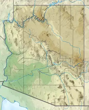 Bisbee Group (Arizona) | |
Description
The group consists of sandstone, claystone, limestone, and conglomerate,[1] with a total thickness of 4,750 feet (1,450 m).[3] In the Tombstone, Arizona, area, it overlies the Naco Formation.[4] In the Bisbee area, the group is divided into four formations, which in ascending stratigraphic order are the Glance Conglomerate, the Morita Formation, the Mural Limestone, and the Cintura Formation.[3] The group is overlain by the Bronco Volcanics,[5] the Nipper Formation, or the Faraway Ranch Formation.[6][2]
In southwestern New Mexico, the group thickens to 21,000 feet (6,400 m) and is divided into the Glance Conglomerate, the Hell-to-Finish Formation, the U-Bar Formation, and the Mojado Formation.[7][8][9][2]
Fossils
The group contains fossils such as the mollusc Exogyra and the clam Trigonia characteristic of the Cretaceous.[1]
History of investigation
The Bisbee beds were first named by E.T. Dumble in 1902 for exposures around Bisbee, Arizona.[1] In 1904, Frederick Leslie Ransome divided the Bisbee Group into formations in the Bisbee area.[3] By 1938, the group had been mapped into the Tombstone, Arizona area[4] and into southwestern New Mexico.[7] Samuel G. Lasky defined several new formations within the group, but some of these were synonyms for each other due to fault doubling.[8]
See also
References
External links
- Butler, B.S.; Wilson, E.D.; Rasor, C.A. (1938). "Geology and ore deposits of the Tombstone district, Arizona". Arizona Bureau of Mines Bulletin. 143. Retrieved 10 September 2020.
- Drewes, Harald (1991). "Geologic map of the Big Hatchet Mountains, Hidalgo County, New Mexico". U.S. Geological Survey Report. doi:10.3133/i2144.
- Dumble, E.T. (1902). "Notes on the geology of southeastern Arizona". American Institute of Mining and Metallurgical Engineers Transactions. 31: 103–105.
- Gilluly, J. (1 December 1945). "Emplacement of the Uncle Sam porphyry, Tombstone, Arizona". American Journal of Science. 243 (12): 643–666. Bibcode:1945AmJS..243..643G. doi:10.2475/ajs.243.12.643.
- Lasky, Samuel G. (1938). "Newly Discovered Section of Trinity Age in Southwestern New Mexico". AAPG Bulletin. 22. doi:10.1306/3D932F80-16B1-11D7-8645000102C1865D.
- Lawton, Timothy F. (2004). "Upper Jurassic and lower Cretaceous strata of southwestern New Mexico and Northern Chihuaua, Mexico". In Mack, G.H.; Giles, K.A. (eds.). The geology of New Mexico. A geologic history: New Mexico Geological Society Special Volume 11. pp. 95–136. ISBN 9781585460106.
- Ransome, F.L. (1904). "The geology and ore deposits of the Bisbee quadrangle, Arizona". U.S. Geological Survey Professional Paper. Professional Paper. 21. doi:10.3133/pp21. hdl:2346/61697. Retrieved 10 September 2020.
- Sabins, Floyd F. (1957). "Geology of the Cochise Head and Western Part of the Vanar Quadrangles, Arizona". Geological Society of America Bulletin. 68 (10): 1315. Bibcode:1957GSAB...68.1315S. doi:10.1130/0016-7606(1957)68[1315:GOTCHA]2.0.CO;2.
- Zeller, R.A., Jr. (1970). "Geology of the Little Hatchet Mountains, Hidalgo and Grant Counties, New Mexico" (PDF). New Mexico Bureau of Mines and Mineral Resources Bulletin. 96. Retrieved 10 September 2020.