Mojado Formation
The Mojado Formation is a geologic formation in southwestern New Mexico. It preserves fossils dating back to the early Cretaceous period.[1][2]
| Mojado Formation Stratigraphic range: early Cretaceous | |
|---|---|
| Type | Formation |
| Underlies | Cowboy Spring Formation |
| Overlies | U-Bar Formation |
| Thickness | 5,150–7,800 feet (1,570–2,380 m) |
| Lithology | |
| Primary | Sandstone |
| Other | Shale, limestone, siltstone |
| Location | |
| Coordinates | 31.505910°N 108.387181°W |
| Region | New Mexico |
| Country | United States |
| Type section | |
| Named for | Mojado Pass |
| Named by | R.A. Zeller Jr. |
| Year defined | 1962 |
 Mojado Formation (the United States) 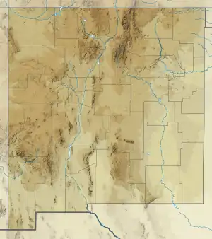 Mojado Formation (New Mexico) | |
Description
The formation consists mostly of sandstone and shale, with some limestone, and siltstone.[3] It rests conformably on the U-Bar Formation[2] and is unconformably overlain by the Cowboy Spring Formation.The total thickness is 5,150–7,800 feet (1,570–2,380 m).[4]
Lucas et al. assign the formation to the Bisbee Group and divided it into the Fryingpan Spring, Sarten, Beartooth, and Rattlesnake Ridge members.[3]
The Fryingpan Spring Member is interpreted as continental deltaic sedimentation.[5] The Sarten Member is fluvial while the Rattlesnake Ridge Member represents a return to shallow marine conditions.[6]
Fossils
The formation contains fossil mollusks such as gastropods, ammonites, and pelecypod,[2] foraminifera, and scaphopods. These date the formation to the late Albian.[4]
History of investigation
The formation name was first used by Zeller in 1962,[1] but he did not formally name the formation until 1965.[2] In 1998, Lucas et al. assigned the formation to the Bisbee Group and divided it into the Fryingpan Spring, Sarten, Beartooth, and Rattlesnake Ridge members.[3] However, Lawton abandoned the Beartooth Member in 2004.[6]
Footnotes
- Zeller 1962
- Zeller 1965
- Lucas et al. 1998
- Zeller and Alper 1965
- Hayes 1970
- Lawton 2004, p. 162-163
References
- Hayes, P.T. (1970). "Cretaceous paleogeography of southeastern Arizona and adjacent areas". U.S. Geological Survey Professional Paper. 658-B: B1–B42. Retrieved 5 August 2020.
- Lawton, Timothy F. (2004). "Upper Jurassic and lower Cretaceous strata of southwestern New Mexico and northern Chihuahua, Mexico". In Mack, G.H.; Giles, K.A. (eds.). The geology of New Mexico. A geologic history: New Mexico Geological Society Special Volume 11. pp. 153–168. ISBN 9781585460106.
- Lucas, Spencer G.; Estep, John W. (1998). "Lithostratigraphy and biostratigraphy of the lower-middle Cretaceous Bisbee group, southwestern New Mexico". New Mexico Museum of Natural History and Science Bulletin. 14. Retrieved 5 August 2020.
- Zeller, R.A., Jr. (1962). "Reconnaissance geologic map of southern Animas Mountains [New Mexico]". New Mexico Bureau of Mines and Mineral Resources Geologic Map. 17. Retrieved 5 August 2020.
- Zeller, R.A., Jr. (1965). "Stratigraphy of the Big Hatchet Mountains Area, New Mexico". New Mexico Bureau of Mines and Mineral Resources Memoir. 16.
- Zeller, R.A., Jr.; Alper, A.M. (1965). "Geology of the Walnut Wells quadrangle, Hidalgo County, New Mexico" (PDF). New Mexico Bureau of Mines and Mineral Resources Bulletin. 84. Retrieved 5 August 2020.