Bisztynek
Bisztynek [bʲiʂˈtɨnɛk] (German: Bischofstein) is a town in Bartoszyce County, Warmian-Masurian Voivodeship, Poland, with 2,418 inhabitants (2016). It is located in Warmia.
Bisztynek | |
|---|---|
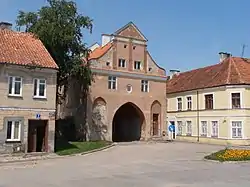
 Lidzbark Gate (Brama Lidzbarska) | |
 Flag  Coat of arms | |
 Bisztynek | |
| Coordinates: 54°4′N 20°54′E | |
| Country | |
| Voivodeship | Warmian-Masurian |
| County | Bartoszyce |
| Gmina | Bisztynek |
| Established | 14th century |
| Area | |
| • Total | 2.16 km2 (0.83 sq mi) |
| Population (2016) | |
| • Total | 2,418 |
| • Density | 1,100/km2 (2,900/sq mi) |
| Time zone | UTC+1 (CET) |
| • Summer (DST) | UTC+2 (CEST) |
| Postal code | 11-230 |
| Website | Bisztynek.com |
History
The town was part of Poland until the First Partition of Poland in 1772, when it was annexed by the Kingdom of Prussia, and from 1871 to 1945 it was also part of Germany. As a result of the treaty of Versailles the 1920 East Prussian plebiscite was organized on 11 July 1920 under the control of the League of nations, which resulted in 2,581 votes to remain in Germany and none for Poland.[1]
After World War II the region was placed under Polish administration by the Potsdam Agreement under territorial changes demanded by the Soviet Union. The town's German population fled or was expelled in accordance to the Potsdam Agreement. The town was resettled by Poles, many of them expelled from the Polish areas annexed by the Soviet Union, or forced to settle in the area through Operation Vistula in 1947.
Sports
The local football team is Reduta Bisztynek, which competes in the lower leagues.[2]
Gallery
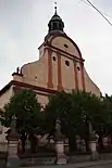
 Saint Matthias church (Baroque)
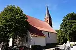
 Saint Michael church (Baroque and Gothic Revival)
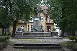
 Henryk Sienkiewicz monument
 Post office
References
- Marzian, Herbert; Kenez, Csaba (1970). Selbstbestimmung für Ostdeutschland – Eine Dokumentation zum 50 Jahrestag der ost- und westpreussischen Volksabstimmung am 11. Juli 1920 (in German). p. 107.
- "Informacje". Reduta Bisztynek (in Polish). Retrieved 20 March 2020.