Black Mesa State Park
Black Mesa State Park is an Oklahoma state park in Cimarron County, near the western border of the Oklahoma panhandle and New Mexico. The park is located about 15 miles (24 km) away from its namesake, Black Mesa, the highest point in Oklahoma (4,973 feet (1,516 m) above sea level). The mesa was named for the layer of black lava rock that coats it.[3]
| Black Mesa State Park | |
|---|---|
 Storm at Black Mesa State Park, April 2012 | |
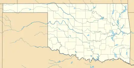 | |
| Location | Cimarron County, Oklahoma, United States |
| Nearest city | Boise City, OK |
| Coordinates | 36.8458550°N 102.8802025°W[1] |
| Area | 349 acres (141 ha) |
| Governing body | Oklahoma Tourism and Recreation Department |
| www | |
The associated nature preserve is open to hiking and contains 1,600 acres (6.5 km2) and is home to 23 rare plants and 8 rare animal species.[3]
The nearest community is Kenton, Oklahoma.[3] The nearest town is Boise City, Oklahoma.
Carl Etling Lake
Carl Etling Lake, formed in 1959 by a dam built on Carrizo Creek, is contained within Black Mesa State Park. It has a shoreline of 5 miles (8.0 km), an average depth of 11 feet (3.4 m), with a maximum depth of 38 feet (12 m).[4] The lake reportedly has a surface area of 200 acres (810,000 m2).[5]
External links
- "Black Mesa Area." Tulsa Audubon Society. Updated May 2010. Retrieved December 4, 2013.
- Suneson, Neil H. and Kenneth V. Luna. "A Field Trip Guide to the Geology of the Black Mesa State Park Area, Cimarron County, Oklahoma." Oklahoma Geological Survey. (1999). Retrieved December 4, 2013.
References
- "Black Mesa State Park". Geographic Names Information System. United States Geological Survey. Retrieved January 6, 2013.
- "Black Mesa State Park". Geographic Names Information System. United States Geological Survey. Retrieved January 6, 2013.
- "Black Mesa State Park and Nature Preserve". Oklahoma Tourism and Recreation Department. Retrieved January 6, 2013.
- Leisure and Sports Review (LASR). "Lake Carl G. Etling, OK." Retrieved December 4, 2013.
- Lewis, Tom and Sara Jane Richter. "Black Mesa." Encyclopedia of Oklahoma History and Culture. Accessed February 9, 2019.