Blair Municipal Airport
Blair Municipal Airport (ICAO: KBTA, FAA LID: BTA) is about seven miles south of Blair, Nebraska, a city in Washington County, Nebraska.
Blair Municipal Airport | |||||||||||
|---|---|---|---|---|---|---|---|---|---|---|---|
| Summary | |||||||||||
| Airport type | Public | ||||||||||
| Owner | Blair Airport Authority | ||||||||||
| Serves | Blair, Nebraska and Omaha, Nebraska | ||||||||||
| Elevation AMSL | 1,317.6 ft / 402 m | ||||||||||
| Coordinates | 41°24′53″N 096°06′32″W | ||||||||||
| Website | |||||||||||
| Map | |||||||||||
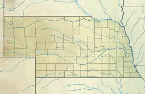 BTA  BTA | |||||||||||
| Runways | |||||||||||
| |||||||||||
| Statistics (2018) | |||||||||||
| |||||||||||
Source: AirNav | |||||||||||
History
The original Blair Municipal Airport (FAA LID: NE07/83Y) north of Blair opened between 1938-1941. In 1996 the city of Blair purchased the privately-owned Eagle Airfield (FAA LID: K46) which became the site of the present Blair Municipal Airport.[2] Eagle Airfield was renamed, and extensive construction replaced the original narrow runway, removed a grass cross-runway, and added new tarmacs and hangars.[3] The original airport location was demolished and turned into a golf course by 1999.[4]
The Omaha Police Department's Air Support Unit began operating out of the airport in June 2019, moving from the North Omaha Airport.[5][6]
Facilities
The airport is at an elevation of 1317.6 (401.6 m). It has one concrete runway: 13/31 is 4,201 by 100 feet (1,280 x 30 m), as well as a grass strip for glider operations. The airport has an average of 42/day operations in the year ending May 2018. 64 aircraft were then based at this airport.
References
- http://www.enterprisepub.com/news/local_news/blair-airport-possible-expansion-in-future/article_2711ec6e-af6f-11e7-8d9e-037606ed35fd.html
- http://www.enterprisepub.com/news/local_news/blair-airport-possible-expansion-in-future/article_2711ec6e-af6f-11e7-8d9e-037606ed35fd.html
- http://www.airfields-freeman.com/NE/Airfields_NE_NE.htm#blair
- http://www.omaha.com%2Fnews%2Fmetro%2Fomaha-police-helicopters-will-move-to-blair-but-one-councilman%2Farticle_2837c650-d3ad-520d-9c07-17d30d6fd829.html&usg=AOvVaw0oRh3NskqcZDnSFWO8Q8gZ
- See OPD Police Helicopter tweet from June 25, 2019, confirming the move.