Bloemhof
Bloemhof is an agricultural town of about 2,000 inhabitants situated on the banks of the Vaal River in North West Province of South Africa.
Bloemhof | |
|---|---|
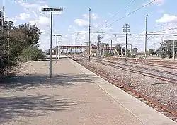 Bloemhof railway station | |
 Bloemhof  Bloemhof | |
| Coordinates: 27°39′0″S 25°35′24″E | |
| Country | South Africa |
| Province | North West |
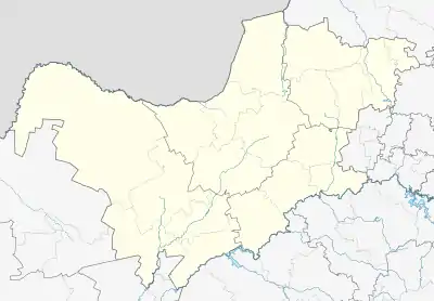
| District | Dr Ruth Segomotsi Mompati |
| Municipality | Lekwa-Teemane |
| Established | 1864[1] |
| Area | |
| • Total | 47.33 km2 (18.27 sq mi) |
| Population | |
| • Total | 2,339 |
| • Density | 49/km2 (130/sq mi) |
| Racial makeup (2011) | |
| • Black African | 26.5% |
| • Coloured | 7.0% |
| • Indian/Asian | 4.2% |
| • White | 61.9% |
| • Other | 0.4% |
| First languages (2011) | |
| • Afrikaans | 72.1% |
| • Tswana | 7.4% |
| • English | 7.3% |
| • Sotho | 4.1% |
| • Other | 8.9% |
| Time zone | UTC+2 (SAST) |
| Postal code (street) | 2660 |
| PO box | 2660 |
| Area code | 053 |
History
It was founded in August 1864 when diamonds were discovered in the area.[4] The town was established on the farm owned by John Barclay, who survived the HMS Birkenhead shipwreck in 1852. The place became known as Bloemhof (flower court) because of the lovely gardens that were planted by Barclay's daughter. In June 1869, the South African Republic's Volksraad created a new district called Bloemhof named after the town itself.[4] Currently Bloemhof has a variety of social milieus; it has a township called Boitumelong and former coloured residence called Coverdale. Salamat is also a small residence, formerly an Indian suburb, which is situated in this town.
Education
- Bloemhof Combined School
- Bloemhof primary School
- Boitumelong primary Schoo
- Gaopalelwe Senior Secondary School
- Matlhajaneng Public Primary School
- Thamagane Primary School
- Thuto-Lore Secondary school
- Tshenolo Primary School
- Vaaloewer Combined School.
Tourist attractions
- Bloemhof Dam
- Bloemhof Dam Nature Reserve
- Sandveld Nature Reserve
- SA Lombard Nature Reserve
References
- "Chronological order of town establishment in South Africa based on Floyd (1960:20-26)" (PDF). pp. xlv–lii.
- "Main Place Bloemhof". Census 2011.
- Bloemhof SP from Census 2011.
- Theal, George McCall (1889). History of South Africa: the republics and native territories from 1854 to 1872. London: S. Sonnenschein & co. p. 230.
Places adjacent to Bloemhof | |
|---|---|
Municipalities and communities of Dr Ruth Segomotsi Mompati District Municipality, North West | ||
|---|---|---|
District seat: Vryburg | ||
| Naledi | .svg.png.webp) Dr Ruth Segomotsi Mompati District within South Africa | |
| Mamusa | ||
| Greater Taung | ||
| Lekwa-Teemane | ||
| Kagisano/Molopo | ||
