Bob Michel Bridge
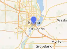
The Bob Michel Bridge (formerly called Franklin Street Bridge[3]) carries Illinois Route 40 over the Illinois River 0.75 miles (1.21 km) up-river from the Cedar Street Bridge. Illinois 40 terminates at an interchange with Interstate 74 just east of the bridge. The bridge serves as a direct surface route from a major commercial center in East Peoria to the Civic Center in downtown Peoria. When completed in 1993, the Bob Michel Bridge replaced the antiquated Franklin Street Bridge, a bascule and truss bridge, which had been located on an adjacent site since 1913. The Bob Michel Bridge is the only river crossing in the Peoria area to accommodate pedestrians and cyclists.
Bob Michel Bridge | |
|---|---|
 Bob Michel Bridge over the Illinois River in Peoria, Illinois | |
| Coordinates | 40.684511°N 89.591886°W |
| Carries | 4 lanes of ILL 40, sidewalk |
| Crosses | Illinois River |
| Locale | Peoria, Illinois and East Peoria, Illinois |
| Official name | Robert Michel Bridge |
| Maintained by | Illinois Department of Transportation |
| ID number | 000090012230539 |
| Characteristics | |
| Design | Steel girder |
| Total length | 2,365 ft (720.9 m) |
| Width | 62.0 ft (18.9 m) |
| Load limit | 44.1 metric tons |
| Clearance below | 65.9 ft (20.1 m)[1] |
| History | |
| Opened | 1993 |
| Statistics | |
| Daily traffic | 18,600[2] |
| Location | |

| |
Prior to the development of the area as a commercial center, the Michel Bridge served a largely industrial area in East Peoria, including many buildings owned by nearby Caterpillar, Inc. The bridge was located at the end of an exit named "Industrial Spur". It has since been renamed to "Riverfront Drive" to account for the new commercial complex.
The Bob Michel Bridge is named after former Congressman Robert H. Michel, a Peoria-area Republican who served as a Congressman from 1957 to 1995 and as House Minority Leader from 1981 until his retirement.
The bridge is located at mile 162.3 of the Illinois River.[1]
References
- Light List, Volume V, Mississippi River System (PDF). Light List. United States Coast Guard. 2006.
- Illinois Department of Transportation (2003). "Getting Around Illinois: AADT". Archived from the original on 2007-02-19. Retrieved 2007-03-22.
- Illinois Department of Transportation (1993). Illinois Highway Map (Map) (1993–1994 ed.). [1:762,500]. Springfield: Illinois Department of Transportation. Retrieved September 18, 2020 – via Illinois Digital Archives.
