Boos, Mayen-Koblenz
Boos is a municipality in the county of Mayen-Koblenz in Rhineland-Palatinate, western Germany.
Boos | |
|---|---|
 Coat of arms | |
Location of Boos within Mayen-Koblenz district 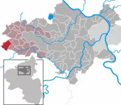 | |
 Boos  Boos | |
| Coordinates: 50°18′47″N 7°1′10″E | |
| Country | Germany |
| State | Rhineland-Palatinate |
| District | Mayen-Koblenz |
| Municipal assoc. | Vordereifel |
| Government | |
| • Mayor | Friedhelm Stephani |
| Area | |
| • Total | 10.38 km2 (4.01 sq mi) |
| Elevation | 470 m (1,540 ft) |
| Population (2019-12-31)[1] | |
| • Total | 608 |
| • Density | 59/km2 (150/sq mi) |
| Time zone | UTC+01:00 (CET) |
| • Summer (DST) | UTC+02:00 (CEST) |
| Postal codes | 56729 |
| Dialling codes | 02656 |
| Vehicle registration | MYK |
| Website | www.boos-eifel.de |
Geography
The parish lies in the East Eifel, a mountain region characterised by volcanic maars and covers an area of 10.38 km², of which 5.02 km² are forest. In 2000, a nature reserve was established, the Booser Maar, with an area of 1.52 km².
Boos is the westernmost municipality of the county of Mayen-Koblenz and lies in the Volcanic Eifel, around five kilometres southeast of the Nürburgring racetrack. Northwest of the village is the Eifel Tower, erected in 2003, on the 557-metre-high hill of Schneeberg with views over the local area including the Booser Doppelmaar, a double maar.
References
- "Bevölkerungsstand 2019, Kreise, Gemeinden, Verbandsgemeinden". Statistisches Landesamt Rheinland-Pfalz (in German). 2020.
| Authority control |
|---|
This article is issued from Wikipedia. The text is licensed under Creative Commons - Attribution - Sharealike. Additional terms may apply for the media files.