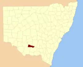
Boyd County, New South Wales
Boyd County is one of the 141 Cadastral divisions of New South Wales. It contains the locality of Coleambally. The Murrumbidgee River is the northern boundary.
| Boyd New South Wales | |||||||||||||||
|---|---|---|---|---|---|---|---|---|---|---|---|---|---|---|---|
 Location in New South Wales | |||||||||||||||
| |||||||||||||||
.png.webp)
Boyd County NSW as shown on John Sands 1886 map).[1]
Boyd County was named in honour of Benjamin Boyd, entrepreneur (1796-1851).[2]
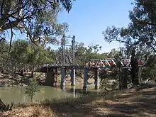
The Carathool Bridge over the Murrumbidgee between Boyd and Sturt
Parishes within this county
A full list of parishes found within this county; their current LGA and mapping coordinates to the approximate centre of each location is as follows:
References
- The New atlas of Australia (John Sands 1886) map 21.
- "Boyd County". Geographical Names Register (GNR) of NSW. Geographical Names Board of New South Wales.

This article is issued from Wikipedia. The text is licensed under Creative Commons - Attribution - Sharealike. Additional terms may apply for the media files.