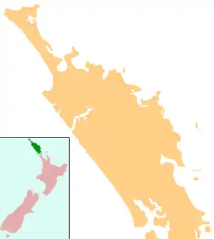
Broadwood, New Zealand
Broadwood is a town about 25 km to the north of the north side of the Hokianga harbour, in Northland, New Zealand. Herekino is 21 km to the west, and Mangamuka Bridge is the same distance to the east.[1][2]
Broadwood | |
|---|---|
 Broadwood | |
| Coordinates: 35°15′38″S 173°23′36″E | |
| Country | New Zealand |
| Region | Northland Region |
| District | Far North District |
The Broadwood area was first settled by Pakeha in the 1880s, and an access road was constructed through the area from Takahue to Motukaraka on the Hokianga harbour. An unmetalled road through the Te Karae Valley to Kohukohu was constructed in 1908.[3]
Demographics
| Year | Pop. | ±% p.a. |
|---|---|---|
| 2006 | 747 | — |
| 2013 | 624 | −2.54% |
| 2018 | 726 | +3.07% |
| Source: [4] | ||
The statistical area of Kohukohu-Broadwood, which at 209.20 square km is much larger than this town, covers the area north of the Hokianga Harbour between Kohukohu and Broadwood. Kohukohu-Broadwood had a population of 726 at the 2018 New Zealand census, an increase of 102 people (16.3%) since the 2013 census, and a decrease of 21 people (-2.8%) since the 2006 census. There were 285 households. There were 378 males and 345 females, giving a sex ratio of 1.1 males per female. Of the total population, 135 people (18.6%) were aged up to 15 years, 84 (11.6%) were 15 to 29, 336 (46.3%) were 30 to 64, and 168 (23.1%) were 65 or older. Figures may not add up to the total due to rounding.
Ethnicities were 62.0% European/Pākehā, 53.3% Māori, 7.9% Pacific peoples, 3.3% Asian, and 1.7% other ethnicities. People may identify with more than one ethnicity.
The percentage of people born overseas was 14.5, compared with 27.1% nationally.
Although some people objected to giving their religion, 40.9% had no religion, 40.1% were Christian, and 8.3% had other religions.
Of those at least 15 years old, 87 (14.7%) people had a bachelor or higher degree, and 144 (24.4%) people had no formal qualifications. The median income was $18,700. The employment status of those at least 15 was that 180 (30.5%) people were employed full-time, 75 (12.7%) were part-time, and 51 (8.6%) were unemployed.[4]
Education
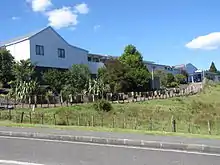
Broadwood Area School is a coeducational composite (years 1-15) school with a roll of 88 students as of March 2020.[5][6] It was founded in 1908,[7] and became a District High School in 1952, and an Area School in 1973. A state aided school functioned at Broadwood from 1895–1904.[8]
Notes
- Peter Dowling (editor) (2004). Reed New Zealand Atlas. Reed Books. pp. map 3. ISBN 0-7900-0952-8.CS1 maint: extra text: authors list (link)
- Roger Smith, GeographX (2005). The Geographic Atlas of New Zealand. Robbie Burton. pp. map 18. ISBN 1-877333-20-4.
- Olive Harris and Chris Lancaster, ed. (2006). "Nearby Broadwood and Runaruna". Remember the Hokianga. p. 89. ISBN 978-0-473-11859-4.
- "Statistical area 1 dataset for 2018 Census". Statistics New Zealand. March 2020. Kohukohu-Broadwood (101700). 2018 Census place summary: Kohukohu-Broadwood
- "New Zealand Schools Directory". New Zealand Ministry of Education. Retrieved 26 April 2020.
- Education Counts: Broadwood Area School
- "Broadwood Area School Centennial".
- "Broadwood Area School (X366)". Archived from the original on 15 October 2008. Retrieved 8 August 2014.