Broughton Archipelago
Broughton Archipelago is a group of islands located at the eastern end of Queen Charlotte Strait in Mount Waddington Regional District, British Columbia. The archipelago is the traditional territory of the Musgamagw Dzawada'enuxw, Namgis, Ma'amtagila and Tlowitsis nations of the Kwakwaka'wakw peoples.
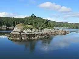 Forested islet in Beware Passage | |
 Broughton Archipelago  Broughton Archipelago | |
| Geography | |
|---|---|
| Location | Queen Charlotte Strait |
| Coordinates | 50°40′N 126°30′W |
| Administration | |
| Province | British Columbia |
| Regional District | Mount Waddington |
Etymology
Broughton Archipelago was named in 1792 by George Vancouver in honour of William Robert Broughton, the captain of the expedition's second ship, HMS Chatham.[1]
Geography
The Broughton Archipelago includes numerous of islands and islets scattered throughout the eastern end of Queen Charlotte Strait. The largest island of the archipelago is Gilford Island with a total area of 384 km2 (148 sq mi).[2] Cormorant Island is the most densely populated island with 270 residents/km2 (710 residents/mi2) as of 2016.[3]
The major islands of the Broughton Archipelago are as follows:
- Baker Island
- Bonwick Island
- Broughton Island
- Cormorant Island
- Crease Island
- East Cracroft Island
- Eden Island
- Gilford Island
- Hanson Island
- Harbledown Island
- Malcolm Island
- Midsummer Island
- Minstrel Island
- North Broughton Island
- Swanson Island
- Turnour Island
- Village Island
- Viscount Island
- Watson Island
- West Cracroft Island
Major waterways
Major waterways include Beware Passage, Broughton Strait, Clio Channel, Fife Sound, Johnstone Strait, Kingcome Inlet, Knight Inlet, Retreat Passage, Tribune Channel, and Wells Passage.
Fishing
The archipelago has been the focus of controversy over commercial fish-farming by Norwegian aquaculture companies. One of the most prominent studies carried out to assess the relationship between fish farms and sea lice infestations on wild species was carried out in this archipelago in the spring of 2002. Additionally, the sediment and waste released from such industrial aquaculture has recently been shown to severely impact the health of glass sponge reefs, which are one of the most ancient forms of animal life on earth and remain unique to specific regions in the Pacific Northwest.
Conservation
The archipelago is rich in biodiversity and culturally significant sites. Protected areas include Broughton Archipelago Conservancy, Broughton Archipelago Provincial Park, Burdwood Group Conservancy, Cormorant Channel Marine Provincial Park, Echo Bay Marine Provincial Park, and Qwiquallaaq/Boat Bay Conservancy.
See also
References
- "Broughton Archipelago". apps.gov.bc.ca. Retrieved 2020-10-02.
- "Atlas of Canada - Sea Islands". Atlas.nrcan.gc.ca. 2009-08-12. Archived from the original on 2013-01-22. Retrieved 2019-05-14.
- Government of Canada, Statistics Canada (2017-02-08). "Census Profile, 2016 Census - Alert Bay, Village [Census subdivision], British Columbia and Mount Waddington, Regional district [Census division], British Columbia". www12.statcan.gc.ca. Retrieved 2020-10-02.
