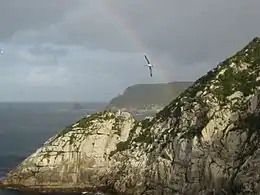
Broughton Island, New Zealand
Broughton Island is the second largest island of The Snares,[1] at 48°02′35″S 166°37′15″E. It sits just off the South Promontory of the main island North East Island, which itself lies approximately 200 kilometres (120 mi) south of New Zealand's South Island.
 | |
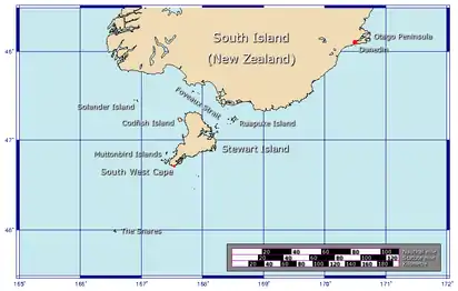 The position of The Snares relative to New Zealand | |
| Geography | |
|---|---|
| Coordinates | 48°02′35″S 166°37′15″E |
| Archipelago | The Snares |
| Length | 1 km (0.6 mi) |
| Width | 0.5 km (0.31 mi) |
| Highest elevation | 86 m (282 ft) |
| Administration | |
| Demographics | |
| Population | 0 |
The island is some 1 by 0.5 km (0.62 by 0.31 mi) in size, with the main axis running northeast to southwest, and the highest elevation is 86 m (282 ft). The island is named after William Robert Broughton.[1]
See also
- New Zealand Subantarctic Islands
- List of Antarctic and subantarctic islands#List of subantarctic islands
- List of islands of New Zealand
- List of islands
- Desert island
References
- (DOC), corporatename = New Zealand Department of Conservation. "Snares Islands: New Zealand's subantarctic islands". www.doc.govt.nz. Retrieved 2 December 2015.
This article is issued from Wikipedia. The text is licensed under Creative Commons - Attribution - Sharealike. Additional terms may apply for the media files.