Brownstown Township, Jackson County, Indiana
Brownstown Township is one of twelve townships in Jackson County, Indiana, United States. At the 2010 census, its population was 5,552 and it contained 2,308 housing units.[1]
Brownstown Township | |
|---|---|
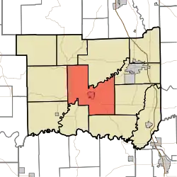 Location in Jackson County | |
| Coordinates: 38°53′26″N 86°02′49″W | |
| Country | United States |
| State | Indiana |
| County | Jackson |
| Government | |
| • Type | Indiana township |
| Area | |
| • Total | 63.62 sq mi (164.8 km2) |
| • Land | 62.72 sq mi (162.4 km2) |
| • Water | 0.9 sq mi (2 km2) 1.41% |
| Elevation | 551 ft (168 m) |
| Population (2010) | |
| • Total | 5,552 |
| • Density | 88.5/sq mi (34.2/km2) |
| GNIS feature ID | 0453143 |
History
Brownstown Township was organized in 1817, and took its name from Brownstown, the county seat.[2] Shields' Mill Covered Bridge was listed on the National Register of Historic Places in 2016.[3]
Geography
According to the 2010 census, the township has a total area of 63.62 square miles (164.8 km2), of which 62.72 square miles (162.4 km2) (or 98.59%) is land and 0.9 square miles (2.3 km2) (or 1.41%) is water.[1] The streams of Ballard Creek, Hough Creek, Kiper Creek, Spray Creek, West Branch White Creek and White Creek run through this township.
Cities and towns
- Brownstown (the county seat)
Unincorporated towns
Adjacent townships
- Hamilton Township (northeast)
- Jackson Township (east)
- Washington Township (east)
- Grassy Fork Township (southeast)
- Carr Township (southwest)
- Driftwood Township (southwest)
- Owen Township (west)
- Pershing Township (northwest)
Cemeteries
The township contains ten cemeteries: Burrell, Durland, First German Presbyterian, Miller, Robertson, Saint Pauls, Smallwood, Wayman, Weathers and Woodmansee.
Major highways
Education
Brownstown Township residents may obtain a free library card from the Brownstown Public Library in Downtown Brownstown.[4]
References
- "Brownstown Township, Jackson County, Indiana". Geographic Names Information System. United States Geological Survey. Retrieved 2009-09-24.
- United States Census Bureau cartographic boundary files
- "Population, Housing Units, Area, and Density: 2010 - County -- County Subdivision and Place -- 2010 Census Summary File 1". United States Census. Archived from the original on 2020-02-12. Retrieved 2013-05-10.
- History of Jackson County, Indiana: From the Earliest Time to the Present, with Biographical Sketches, Notes, Etc., Together with an Extended History of the Northwest, the Indiana Territory and the State of Indiana. Unigraphic. 1886. p. 362.
- "National Register of Historic Places Listings". Weekly List of Actions Taken on Properties: 6/06/16 through 6/10/16. National Park Service. 2016-06-17.
- "Overview". Brownstown Public Library. Retrieved 8 March 2018.
External links
Municipalities and communities of Jackson County, Indiana, United States | ||
|---|---|---|
| City | Map of Indiana highlighting Jackson County | |
| Towns | ||
| Townships | ||
| CDPs | ||
| Other unincorporated communities | ||
| ||