Brukkaros Mountain
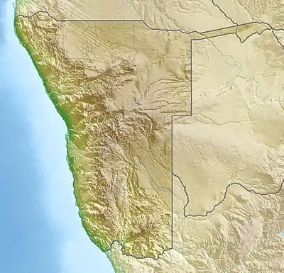
Brukkaros Mountain (Khoekhoe: Geitsi Gubib) is an extinct volcano in ǁKaras Region, Namibia. Measuring 1,590 metres at its peak on the eastern edge of the crater, Brukkaros is located about 15 kilometres northeast of the primarily Nama town of Berseba and 100 kilometres north-northwest of Keetmanshoop.[1] It is over 650 metres taller than the surrounding area, but the crater floor is 350 m below the rim.
| Brukkaros | |
|---|---|
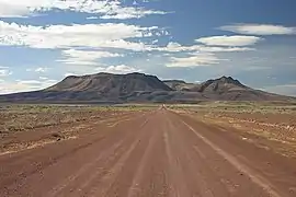 Brukkaros Mountain from the south | |
| Highest point | |
| Elevation | 1,590 m (5,220 ft) |
| Coordinates | 25°52′02″S 017°46′53″E |
| Geography | |
 Brukkaros | |
| Geology | |
| Mountain type | Dome |
| Climbing | |
| Easiest route | Hike |
Description
.jpg.webp)
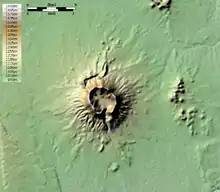
The mountain is a large extinct volcano, in the form of a ring mountain (a so-called tuff ring) with a diameter of about 4 km[2] and has been formed by an explosion when rising magma met groundwater and superheated it. It is formed of an indistinctly bedded red-brown microbreccia, composed of finely fragmented rocks of the Nama System that were blown out of a volcanic vent about 80 million years ago. The breccia layers slope inwards (unlike the slope around a volcanic crater), and removal of the softer upper layers by erosion has created the central hollow.[3] The hollow is drained by a stream which runs southwards through the ring mountain in a narrow valley. The route into the interior of the mountain is along this valley. At its head is a dry waterfall, over which the stream plunges down some 45 m after rain, and the river bed directly below the fall is the principal source of water.[4]
Quiver trees grow extensively on the crater floor. Due to the absence of drinking water and mobile phone service and difficult road access, travel to Brukkaros is difficult.
Etymology
The Nama called the mountain Geitsi Gubib after the long, flowing loincloth worn by Khoikhoi women, known in Afrikaans as broek-en-karos ("trousers and kaross"), rendered in German to Brukkaros.
History
Berseba was founded nearby by the Rhenish Missionary Samuel Hahn in 1850. A heliograph station operated under German administration. From 1926–1931, the National Geographic Society, in cooperation with the Smithsonian Institution, ran the Brukkaros Solar Observatory on the mountain to measure daily solar radiation.[1] Arthur Bleksley worked there during the period.
See also
- Geology of Namibia
- Brukkaros Pygmy Rock Mouse
- NS Brukkaros (C13), a Namibian Navy patrol boat named after the mountain
References
| Wikimedia Commons has media related to Brukkaros Mountain. |
- Brukkaros Mountain Namibia-1on1.com
- South West Africa, 1:50 000 sheet 2517DD Brukkaros (1981). Surveyor-General, Windhoek.
- Martin, H. (1981/2). Der Grosse Brukkaros. Journal of the South West Africa Scientific Society, Vol. 36/37, pp. 7–10.
- Plug, C. (1989). History of the Solar Radiation Expedition to Mount Brukkaros, South West Africa, 1926–1931. South African Journal of Science, Vol. 85, pp. 174–180.
