Bughdasheni Lake
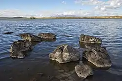
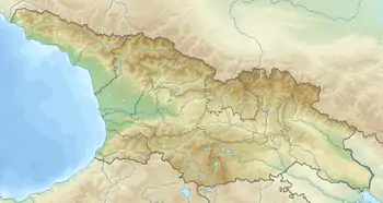
Bughdasheni Lake (Georgian: ბუღდაშენის ტბა) is a volcanic lake[1] in the Ninotsminda Municipality, Samtskhe–Javakheti region of Georgia.[2] located in Javakheti Plateau, at 2040 m above sea level.[1] The area of surface is 0.39 km², while the catchment area is 69.3 km². Average depth is 0.42 m, maximal depth is 0.85 m.[1] Gets its feed from snow, rainfall and underground waters. High water levels at spring, low at autumn. Much of the southern part of this area consists of wetlands.[3] River Bughdasheni (left-bank tributary river Paravani) outflows from the Lake. The lake is rich in fish, including trout.[4] The area around the lake is home for part of the year to many species of migratory birds and the shore largely pristine and undisturbed.[5] Bughdasheni Lake is the part of Bugdasheni Managed Reserve. Since 2020 it has been designated as a Ramsar site.[6]
| Bughdasheni Lake | |
|---|---|
 Bughdasheni Lake | |
 Bughdasheni Lake 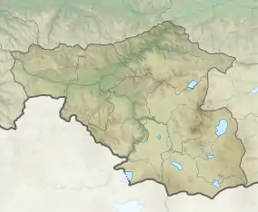 Bughdasheni Lake | |
| Coordinates | 41°12′06″N 43°41′08″E |
| Catchment area | 69.3 km2 (26.8 sq mi) |
| Basin countries | Georgia |
| Surface area | 0.39 km2 (0.15 sq mi) |
| Average depth | 0.42 m (1 ft 5 in) |
| Max. depth | 0.85 m (2 ft 9 in) |
| Water volume | 0.16 million cubic metres (5.7×10⁶ cu ft) |
| Surface elevation | 2,040 m (6,690 ft) |
References
- Ilia Apkhazava. Lakes of Georgia (in russian), p. 50, Tbilisi, Metsniereba, 1975
- Orthographic dictionary of geographic names of Georgian, p. 40, Tbilisi, 2009
- IGS Bughdasheni Lake - Travel to Georgia
- Ilia Apkhazava. Georgian Soviet Encyclopedia, vol. 2, p. 592. Tbilisi.
- Bughdasheni Lake - Agency of Protected Areas of Georgia
- "Bugdasheni Lake". Ramsar Sites Information Service. Retrieved 5 October 2020.
| Eastern Georgia |
| ||||
|---|---|---|---|---|---|
| Western Georgia |
| ||||