Burke Road, Melbourne
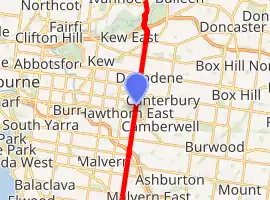
Burke Road is a major north-south thoroughfare in Melbourne, Australia. It runs from Ivanhoe to Caulfield and includes the major shopping district at Camberwell. Burke Road was originally known as Boundary, West Boundary or New Cross Road.[1]
Burke Road | |
|---|---|
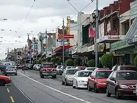 | |
Burke Road, looking north from Camberwell Junction | |
| |
| General information | |
| Type | Road |
| Length | 12 km (7.5 mi) |
| Major junctions | |
| North end | |
| |
| South end | |
| Location(s) | |
| Major suburbs | Kew East, Camberwell, Glen Iris, Malvern East |
The road is aligned with the western boundary of Elgar's Special Survey,[2] and does not conform to the 1 mile (1.6 km) interval cadastral survey grid for Melbourne.
Tram route 72 runs along the road between Malvern and Cotham roads.
See also
![]() Australian Roads portal
Australian Roads portal
Notes and references
- Unknown Author. "Burke Road and Camberwell Junction - Historic Area | National Trust of Australia (Victoria)", National Trust of Australia - Victoria, 2004-09-27. Retrieved on 2009-07-18
- Lay, Maxwell (2003), Melbourne Miles: The Story of Melbourne's Roads, Melbourne: Australian Scholarly Publishing, ISBN 1-74097-019-5
This article is issued from Wikipedia. The text is licensed under Creative Commons - Attribution - Sharealike. Additional terms may apply for the media files.