Burwood Highway
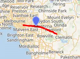
Burwood Highway is a major transportation link with Melbourne's eastern suburbs. It begins in the suburb of Kooyong, Melbourne at the junction of the Monash Freeway as Toorak Road between Monash Freeway and Warrigal Road, and finishes in Belgrave, Victoria in the Dandenong Ranges.[1] The highway is considered a major link for people who live in the Dandenong Ranges, as it is the only major feeder roadway in the general area other than Canterbury Road, Ferntree Gully Road, EastLink and Wellington Road.
Burwood Highway | |
|---|---|
| |
| General information | |
| Type | Highway |
| Length | 31 km (19 mi) |
| Route number(s) |
|
| Former route number | (Upper Ferntree Gully - Belgrave) |
| Major junctions | |
| West end | Kooyong, Melbourne |
| |
| East end | |
| Location(s) | |
| Major settlements | Burwood, Burwood East, Wantirna South, Ferntree Gully, Upwey, Belgrave |
| Highway system | |
Route
Burwood Highway is a primary route between Melbourne and the eastern suburbs, and the area around Belgrave. It begins at its junction with Monash Freeway (or CityLink if travelling north) as a four lane single carriageway, which is often clogged with heavy traffic, as well as trams travelling along the roadway for some of the route. However, this part of the route is usually signed as Toorak Road. After Warrigal Road, the highway widens to become a six lane dual carriageway, the median with trams tracks, carrying the Route 75 service to Vermont South. A few kilometres before Belgrave, the highway narrows again to a single carriageway, its route, number changing from State Route 26 to C412 until its end in Belgrave. C412 continues as Belgrave-Gembrook Road although the end of the highway heading straight forwards continues as Monbulk Road heading towards Lilydale.
Municipalities along the highway
- City of Stonnington (Toorak- Kooyong)
- City of Boroondara (Hawthorn East- Burwood)
- City of Whitehorse (Burwood- Vermont South)
- City of Knox (Wantirna South- Mountain Gate)
- Shire of Yarra Ranges (some of upper Ferntree Gully- Belgrave)
Suburbs along the highway
- Kooyong (City of Stonnington) (7 km from Melbourne)
- Burwood (City of Whitehorse) (12 km from Melbourne)
- Burwood East (City of Whitehorse) (17 km from Melbourne)
- Vermont South (City of Whitehorse) (20 km from Melbourne)
- Wantirna South (City of Knox) (24 km from Melbourne)
- Knoxfield (City of Knox) (26 km from Melbourne)
- Mountain Gate (City of Knox) (27 km from Melbourne)
- Ferntree Gully (City of Knox) (29 km from Melbourne)
- Upper Ferntree Gully (Shire of Yarra Ranges and City of Knox) (31 km from Melbourne)
- Upwey (Shire of Yarra Ranges) (33 km from Melbourne)
- Tecoma (Shire of Yarra Ranges) (34 km from Melbourne)
- Belgrave (Shire of Yarra Ranges) (35 km from Melbourne)
Main Destinations along continued Belgrave- Gembrook Road.
- Emerald (Shire of Cardinia) (46 km from Melbourne) (11 km from Belgrave)
- Cockatoo (Shire of Cardinia) (52 km from Melbourne) (17 km from Belgrave)
- Gembrook (Shire of Cardina) (60 km from Melbourne) (25 km from Belgrave)
Major intersections
| LGA | Location | km | mi | Destinations | Notes |
|---|---|---|---|---|---|
| Stonnington | Kooyong–Malvern boundary | 0 | 0.0 | Western terminus; single-point urban interchange; highway signed as Toorak Road | |
| Boroondara | Hawthorn East | 0.5 | 0.31 | Tooronga Road | |
| Camberwell | 1.3 | 0.81 | |||
| 2.6 | 1.6 | Glen Iris Road – Glen Iris | |||
| 3.2 | 2.0 | All Camberwell Road traffic continues east on Toorak Road | |||
| Boroondara–Whitehorse boundary | Camberwell–Burwood boundary | 5.0 | 3.1 | Burwood Highway signed as Toorak Road west of the intersection | |
| Whitehorse | Burwood | 6.2 | 3.9 | Elgar Road – Doncaster | |
| 7.1 | 4.4 | ||||
| Burwood–Burwood East boundary | 8.2 | 5.1 | |||
| Burwood East | 10.0 | 6.2 | |||
| Burwood East–Forest Hill–Vermont South tripoint | 11.5 | 7.1 | |||
| Knox | Wantirna–Wantirna South boundary | 14.9 | 9.3 | ||
| 15.4 | 9.6 | Diamond interchange | |||
| 17.6 | 10.9 | ||||
| Wantirna South | 18.8 | 11.7 | |||
| Knoxfield–Ferntree Gully boundary | 19.7 | 12.2 | |||
| Ferntree Gully | 21.6 | 13.4 | State Route 22 western concurrency terminus | ||
| 22.3 | 13.9 | State Route 5 north-western concurrency terminus | |||
| 22.7 | 14.1 | State Route 5 south-eastern concurrency terminus | |||
| 23.4 | 14.5 | Brenock Park Drive south / Selman Avenue north – Lysterfield, Rowville, Ferntree Gully | |||
| Knox–Yarra Ranges boundary | Upper Ferntree Gully | 25.4 | 15.8 | Route transition: Eastern terminii of State Routes 22 and 26, western terminus of C412 | |
| Yarra Ranges | Tecoma | 28.1 | 17.5 | Glenfern Road – Rowville | |
| Belgrave | 29.8 | 18.5 | Roundabout; eastern highway terminus | ||
| |||||
See also
- Highways in Australia
- Highways in Victoria
References
- VicRoads. "VicRoads – Register of Public Roads (Part A)". Government of Victoria. pp. 1018–1020. Archived from the original (PDF) on 29 December 2014. Retrieved 25 February 2015.
Road infrastructure in Melbourne | |
|---|---|
| Freeways | |
| Highways |
|
| Bypasses | |
| Bridges and tunnels | |
| Proposals | |
| |