Caher Mountain (Cork)
Caher Mountain (Irish: Cathair = "stone ring-fort") is a hill, 338 metres high, with views of the Sheep's Head peninsula, roughly west of and above the village of Kilcrohane in County Cork, Ireland.[1]
| Caher Mountain | |
|---|---|
| Cathair | |
 Very rough hillside and bog running up to the summit of Caher Mountain | |
| Highest point | |
| Elevation | 338 m (1,109 ft) [1] |
| Prominence | 143 m (469 ft) [1] |
| Coordinates | 51°34′56″N 9°44′32″W |
| Geography | |
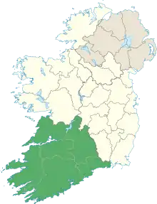
 Caher Mountain Location in Ireland | |
| Location | County Cork, Ireland |
| Parent range | Sheep's Head peninsula |
Location
Caher Mountain is located approximately 15 km from the end of the Sheep's Head peninsula and around 4 km west of Kilcrohane. Its neighbouring summit is Seefin (345 m), some 5 km to the northeast. It is at grid reference V793380 and can be reached on an easy walk from a lay-by about 1.5 km above the village.[1]
Views
In clear weather there are views as far as Dursey Island and the Iveragh Peninsula from Caher Mountain.[1]
References
- Caher Mountain at mountainviews.ie. Accessed on 3 Feb 2013.
This article is issued from Wikipedia. The text is licensed under Creative Commons - Attribution - Sharealike. Additional terms may apply for the media files.