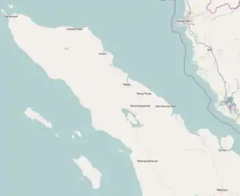
Calang
Calang, the capital of the Aceh Jaya Regency of the special territory (daerah istimewa) of Aceh was on the island of Sumatra, Indonesia. It had a population of about 12,000 though it was reported to have "vanished completely leaving only scattered shards of concrete" as a result of the tsunami produced by the 2004 Indian Ocean earthquake. Only about 30 per cent of the townspeople have survived.
Calang | |
|---|---|
Town | |
 Indonesian Navy landing craft KRI Teluk Banten (516) and KRI Teluk Langsa (501) and a US Navy Seahawk helicopter in Calang | |
| Coordinates: 4°38′N 95°35′E | |
| Country | |
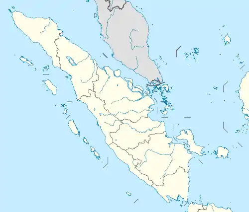
| Region | Sumatra |
| Province | Aceh |
| Regency | Aceh Jaya Regency |
| Time zone | UTC+7 (IWST) |
| Area code | (+62) 654 |


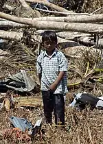
The trail of destruction left by the tsunami extends two kilometers inland from the coast. Whole hills have been washed away.
The township, a former Indonesian Military (TNI, Tentara Nasional Indonesia) stronghold, will be relocated inland according to Indonesian Welfare Minister Alwi Shihab.
Climate
Calang has a tropical rainforest climate (Af) with heavy to very heavy rainfall year-round.
| Climate data for Calang | |||||||||||||
|---|---|---|---|---|---|---|---|---|---|---|---|---|---|
| Month | Jan | Feb | Mar | Apr | May | Jun | Jul | Aug | Sep | Oct | Nov | Dec | Year |
| Average high °C (°F) | 29.1 (84.4) |
30.0 (86.0) |
31.6 (88.9) |
32.3 (90.1) |
31.2 (88.2) |
31.4 (88.5) |
31.0 (87.8) |
31.6 (88.9) |
30.8 (87.4) |
30.9 (87.6) |
29.7 (85.5) |
29.0 (84.2) |
30.7 (87.3) |
| Daily mean °C (°F) | 26.3 (79.3) |
26.6 (79.9) |
27.5 (81.5) |
28.2 (82.8) |
27.8 (82.0) |
27.8 (82.0) |
27.3 (81.1) |
27.9 (82.2) |
27.3 (81.1) |
27.6 (81.7) |
26.8 (80.2) |
26.3 (79.3) |
27.3 (81.1) |
| Average low °C (°F) | 23.5 (74.3) |
23.3 (73.9) |
23.4 (74.1) |
24.1 (75.4) |
24.4 (75.9) |
24.3 (75.7) |
23.7 (74.7) |
24.2 (75.6) |
23.8 (74.8) |
24.4 (75.9) |
23.9 (75.0) |
23.7 (74.7) |
23.9 (75.0) |
| Average rainfall mm (inches) | 231 (9.1) |
170 (6.7) |
234 (9.2) |
287 (11.3) |
327 (12.9) |
266 (10.5) |
285 (11.2) |
312 (12.3) |
369 (14.5) |
384 (15.1) |
357 (14.1) |
250 (9.8) |
3,472 (136.7) |
| Source: Climate-Data.org[1] | |||||||||||||
References
- "Climate: Calang". Climate-Data.org. Retrieved 5 November 2020.