Calico Mountains (California)
The Calico Mountains of California are a mountain range located in the Mojave Desert. The range spans San Bernardino and Inyo counties in California.
| Calico Mountains | |
|---|---|
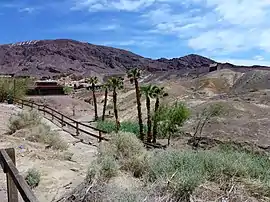 Calico Mountains behind Calico Ghost Town. | |
| Highest point | |
| Peak | Calico Peak |
| Elevation | 1,368.86 m (4,491.0 ft) |
| Geography | |
 Location of Calico Mountains in California[1] | |
| Country | United States |
| State | California |
| Region | Mojave Desert |
| District | San Bernardino County & Inyo County |
| Features | Calico Early Man Site, Rainbow Basin and Calico Ghost Town |
| Range coordinates | 34°58′25″N 116°50′36″W |
| Topo map | USGS Salsberry Peak, Yermo |
Geography
The Calico Mountains are geologically colorful range that lie in a northwest-southeast direction, and are located just north of Barstow and Yermo, and of Interstate 15.
Historic Pickhandle Pass and Jackhammer Gap lie at the northern end of the mountains on Fort Irwin Road, with the Fort Irwin Military Reservation nearby. The Calico Mountains have been active in California mining history.
Peaks
Calico Peak, the highest point, is 4,491-foot (1,369 m) in elevation, in the San Bernardino County portion of the range (N 34.995259 and W -116.838369).[2]
Features
The Rainbow Basin geologic feature, in the Bureau of Land Management managed Rainbow Basin Natural Area, is just north of Barstow.
Calico Ghost Town is located in the Yermo Hills (Calico Hills) at the western edge of the Calico Mountains, north of Yermo.
The Calico Early Man Site is a Paleo-Indians lithic workshop for Stone tools and a simple quarry archaeological site in the mountains also.
See also
- Calico Mountains namesakes
- Calico and Odessa Railroad
- Calico Early Man Site
- Calico Ghost Town
- Calico Peaks
- Calico Print—publication
- Local history
- Borate and Daggett Railroad ( site )
- Waterloo Mining Railroad ( site )
- Francis Marion Smith ( mining )
- Related
- Mountain ranges of the Mojave Desert
- Protected areas of the Mojave Desert
References
- "Calico Mountains". Geographic Names Information System. United States Geological Survey. Retrieved 2009-05-04.
- "Calico Peak in San Bernardino County CA (Yermo Area)". MountainZone. Retrieved 2018-04-30.
- Allan, Stuart (2005). California Road and Recreation Atlas. Benchmark Maps. p. 105. ISBN 0-929591-80-1.
- U.S. Geological Survey Geographic Names Information System: Calico Mountains