Calosso
Calosso is a rural comune (municipality) in the Province of Asti in the Italian region Piedmont, located about 60 kilometres (37 mi) southeast of Turin and about 20 kilometres (12 mi) south of Asti in the hilly area between the Tanaro and Belbo and on the borders between Monferrato and Langa. As of 31 December 2004, it had a population of 1,298 and an area of 15.7 square kilometres (6.1 sq mi).[4]
Calosso | |
|---|---|
| Comune di Calosso | |
 | |
 Coat of arms | |
Location of Calosso 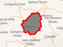
| |
 Calosso Location of Calosso in Italy 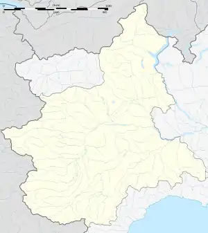 Calosso Calosso (Piedmont) | |
| Coordinates: 44°44′N 8°14′E | |
| Country | Italy |
| Region | Piedmont |
| Province | Province of Asti (AT) |
| Frazioni | frazione Castagna, frazione Piana del Salto, frazione Mosiano, regione Rodotiglia, regione San Bovo, regione Soria [1] |
| Government | |
| • Mayor | Francesca Dalcielo (elected 2004-06-13> |
| Area | |
| • Total | 15.7 km2 (6.1 sq mi) |
| Elevation | 399 m (1,309 ft) |
| Population (Dec. 2004)[3] | |
| • Total | 1,298 |
| • Density | 83/km2 (210/sq mi) |
| Demonym(s) | Calossesi |
| Time zone | UTC+1 (CET) |
| • Summer (DST) | UTC+2 (CEST) |
| Postal code | 14052 |
| Dialing code | 0141 |
| Patron saint | Beato Alessandro Sauli |
| Saint day | 11 October |
| Website | Official website |
The comune borders the following municipalities: Agliano Terme, Canelli, Castiglione Tinella, Costigliole d'Asti, Moasca, and Santo Stefano Belbo.
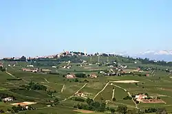
The village itself, together with its castle, stands on a hill surrounded by the vineyards which represent its principal economic activity.
Local government
The comune belongs to the Comunità delle colline tra Langa e Monferrato.
Viticulture
Around two thirds of the area of the commune, and by far the greatest part of its agricultural land is devoted to vineyards. Production is on a small scale: this 10 square kilometres (4 sq mi) or so is divided between 380 farms and the total annual production of wine is around 4,900,000 litres (1,300,000 US gal).
The principal grape variety grown here is the Moscato Bianco, while others include Barbera, Dolcetto, Nebbiolo, Chardonnay and Freisa. Of particular interest is the cultivation of the now rare historical variety Gamba di Pernice (literally ‘Pheasant’s leg’).[5]
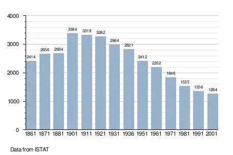
Demographic evolution
References
- Comune di Calosso (AT) - Italia: Informazioni
- "Superficie di Comuni Province e Regioni italiane al 9 ottobre 2011". Istat. Retrieved 16 March 2019.
- "Popolazione Residente al 1° Gennaio 2018". Istat. Retrieved 16 March 2019.
- All demographics and other statistics: Italian statistical institute Istat.
- "Comune di Calloso :: Vignetti". Archived from the original on 2006-05-06. Retrieved 2006-09-21.
