Cape Engaño (Dominican Republic)
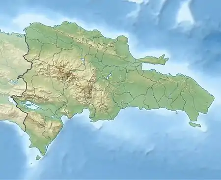
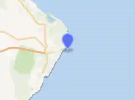
Cabo Engaño is the easternmost point of the island of Hispaniola, on the territory of the Dominican Republic. Cape Engaño contains dangerous reefs near Santo Domingo. Punta Cana International Airport, the nation's busiest, lies slightly south of the cape.
- For the cape of the same name in the Philippines, see Cape Engaño (Luzon).
 Dominican Republic | |
| |
| Location | Cape Engaño Dominican Republic |
|---|---|
| Coordinates | 18°34′01.3″N 68°19′34.6″W |
| Year first constructed | 1915 (first) |
| Year first lit | 1990s |
| Construction | metal skeletal tower |
| Tower shape | square pyramidal tower with balcony |
| Markings / pattern | unpainted tower |
| Tower height | 20 metres (66 ft) |
| Focal height | 43 metres (141 ft) |
| Light source | solar power |
| Range | 11 nautical miles (20 km; 13 mi) |
| Characteristic | Fl W 5s. |
| Admiralty number | J5444 |
| NGA number | 14296 |
| ARLHS number | DOM-005[1][2] |
In 1502, a large part of a Spanish fleet of 30-32 ships filled with treasures and colonists bound for Spain sunk during a violent storm, somewhere close to Cape Engaño. This fleet was sent by order of governor Nicolas Ovando. 5-10 ships, although damaged, survived and returned to the port of departure, except for only one, the "Aguja", which safely reached Spain. [3] [4] [5]
Climate
| Climate data for Cape Engaño (Punta Cana) 1961–1990 | |||||||||||||
|---|---|---|---|---|---|---|---|---|---|---|---|---|---|
| Month | Jan | Feb | Mar | Apr | May | Jun | Jul | Aug | Sep | Oct | Nov | Dec | Year |
| Record high °C (°F) | 31.0 (87.8) |
30.7 (87.3) |
31.2 (88.2) |
32.0 (89.6) |
33.9 (93.0) |
34.4 (93.9) |
34.7 (94.5) |
34.5 (94.1) |
34.6 (94.3) |
33.7 (92.7) |
32.7 (90.9) |
32.5 (90.5) |
34.7 (94.5) |
| Average high °C (°F) | 27.7 (81.9) |
27.6 (81.7) |
28.1 (82.6) |
28.7 (83.7) |
29.6 (85.3) |
30.3 (86.5) |
30.5 (86.9) |
30.7 (87.3) |
30.9 (87.6) |
30.5 (86.9) |
29.4 (84.9) |
28.1 (82.6) |
29.3 (84.7) |
| Daily mean °C (°F) | 24.8 (76.6) |
24.7 (76.5) |
25.0 (77.0) |
25.5 (77.9) |
26.4 (79.5) |
27.2 (81.0) |
27.5 (81.5) |
27.7 (81.9) |
27.6 (81.7) |
27.0 (80.6) |
26.3 (79.3) |
25.2 (77.4) |
26.2 (79.2) |
| Average low °C (°F) | 21.9 (71.4) |
21.8 (71.2) |
22.0 (71.6) |
22.5 (72.5) |
23.2 (73.8) |
24.1 (75.4) |
24.6 (76.3) |
24.8 (76.6) |
24.4 (75.9) |
23.6 (74.5) |
23.2 (73.8) |
22.3 (72.1) |
23.2 (73.8) |
| Record low °C (°F) | 16.0 (60.8) |
14.0 (57.2) |
14.8 (58.6) |
15.2 (59.4) |
16.0 (60.8) |
14.9 (58.8) |
19.0 (66.2) |
17.9 (64.2) |
15.0 (59.0) |
15.0 (59.0) |
15.9 (60.6) |
14.0 (57.2) |
14.0 (57.2) |
| Average rainfall mm (inches) | 66.4 (2.61) |
54.2 (2.13) |
54.2 (2.13) |
69.2 (2.72) |
124.4 (4.90) |
103.9 (4.09) |
78.3 (3.08) |
103.1 (4.06) |
101.7 (4.00) |
152.1 (5.99) |
116.6 (4.59) |
78.5 (3.09) |
1,102.6 (43.41) |
| Average rainy days (≥ 0.1 mm) | 10.0 | 6.8 | 6.7 | 6.6 | 10.1 | 9.2 | 9.1 | 10.0 | 10.4 | 11.4 | 11.5 | 11.0 | 112.8 |
| Average relative humidity (%) | 82.8 | 81.4 | 81.2 | 82.1 | 83.0 | 82.2 | 82.3 | 82.6 | 82.5 | 83.0 | 82.2 | 83.2 | 82.4 |
| Mean monthly sunshine hours | 256.9 | 241.9 | 278.8 | 265.0 | 249.7 | 255.1 | 268.3 | 271.2 | 245.2 | 242.7 | 238.3 | 233.2 | 3,046.3 |
| Source 1: World Meteorological Organization[6] | |||||||||||||
| Source 2: NOAA[7] | |||||||||||||
See also
- Lists of lighthouses and lightvessels
References
- Dominica Republic The Lighthouse Directory. University of North Carolina at Chapel Hill. Retrieved 8 September 2016
- List of Lights, Buoys and Fog Signals Atlantic Coast. Retrieved 8 September 2016
- "Timelines of history. Timeline Dominican Republic" (https://www.timelines.ws/countries/DOMINREP.HTML - viewed May 2018)
- "Colectia Cuceritorii. Cristofor Columb - vazut de un marinar", by J.B. Charcot (translation done by Gabriela Dobrisan), Publishing Prietenii Cartii, Bucharest, Romania, 1998, p. 233-234
- "NOAA/ATLANTIC OCEANOGRAPHIC AND METEOROLOGICAL LABORATORY HURRICANE RESEARCH DIVISION. 515th Anniversary of Columbus’ hurricane encounter" (https://noaahrd.wordpress.com/2017/06/30/515th-anniversary-of-columbus-hurricane-encounter/ - June 2017)
- "World Weather Information Service - Punta Cana". World Meteorological Organization. Retrieved February 23, 2013.
- "Climate Normals for Cabo Engaño (Punta Cana) 1961-1990". National Oceanic and Atmospheric Administration. Retrieved February 23, 2013.
This article is issued from Wikipedia. The text is licensed under Creative Commons - Attribution - Sharealike. Additional terms may apply for the media files.
