Cape Maobitou
Cape Maobitou is a cape in the township of Hengchun in Pingtung County, Taiwan. It lies within Kenting National Park and forms the western boundary of South Bay. It is one of the southernmost points on Taiwan Island.
| Cape Maobitou | |
|---|---|
| 貓鼻頭 | |
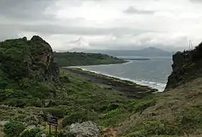 Cape Maobitou (2011) | |
 Taiwan | |
| Location | Hengchun, Pingtung County, Republic of China |
| Coordinates | 21°55′11″N 120°44′22″E |
| Geology | Cape |
| Cape Maobitou | |||||||||||||
|---|---|---|---|---|---|---|---|---|---|---|---|---|---|
 Maobitou (2017) | |||||||||||||
| Traditional Chinese | 貓鼻頭 | ||||||||||||
| Simplified Chinese | 猫鼻头 | ||||||||||||
| Literal meaning | Cat's Nose Cat Cape | ||||||||||||
| |||||||||||||
| Former names | |||||||||||||
|---|---|---|---|---|---|---|---|---|---|---|---|---|---|
.jpg.webp) Waves at Maobitou (2009) | |||||||||||||
| Maobi | |||||||||||||
| Traditional Chinese | 貓鼻 | ||||||||||||
| Simplified Chinese | 猫鼻 | ||||||||||||
| Literal meaning | Cat's Nose Cat Cape | ||||||||||||
| |||||||||||||
Name
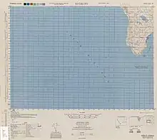
Map including Cape Maobitou (labeled as Byōbi-tō) (1944)
Māobítou is the pinyin romanization of the Mandarin pronunciation of the Chinese name, written 貓鼻頭 in traditional characters and 猫鼻头 in simplified characters. It literally means "Cat Nose Head" but bítou is a simply a clarifying dialectical variation of bí, itself a dialectical name for a headland.
Maobitou or Maobi was formerly known as Niauphi,[1] from the Hokkien form of the name.
![[1]](#cite_note-FOOTNOTECampbell1896[[:c:File:1896_map_of_Taiwan.png|map]]-1)
Transportation
The cape is located near Taiwan's Highway 26.
References
Citations
Bibliography
- Campbell, William (1896), "The Island of Formosa: Its Past and Future", Scottish Geographical Magazine (PDF), Vol. 12, No. 8, pp. 385–399, doi:10.1080/00369229608732903.
This article is issued from Wikipedia. The text is licensed under Creative Commons - Attribution - Sharealike. Additional terms may apply for the media files.