Capulin, Colorado
Capulin is an unincorporated town, a post office, and a census-designated place (CDP) located in Conejos County, Colorado, United States. The Capulin post office has the ZIP Code 81124.[4] At the United States Census 2010, the population of the Capulin CDP was 200, while the population of the 81124 ZIP Code Tabulation Area was 565 including adjacent areas.[5] Conejos County governs the unincorporated town.
Capulin, Colorado | |
|---|---|
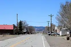 Looking west on Colorado State Highway 15 in Capulin. | |
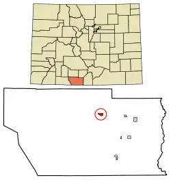 Location of the Capulin CDP in Conejos County, Colorado. | |
 Capulin Location of the Capulin CDP in the United States. | |
| Coordinates: 37°16′55″N 106°06′18″W[1] | |
| Country | |
| State | |
| County | Conejos County |
| Established | 1867[2] |
| Government | |
| • Type | unincorporated town |
| Area | |
| • Total | 0.947 sq mi (2.453 km2) |
| • Land | 0.947 sq mi (2.453 km2) |
| • Water | 0.000 sq mi (0.000 km2) |
| Elevation | 7,805 ft (2,379 m) |
| Population (2010) | |
| • Total | 200 |
| • Density | 211/sq mi (82/km2) |
| Time zone | UTC-7 (MST) |
| • Summer (DST) | UTC-6 (MDT) |
| ZIP Code[4] | 81124 (PO Box) |
| Area code(s) | 719 |
| GNIS feature[3] | Capulin CDP |
History
The town of Capulin was established by settlers from Ojo Caliente, New Mexico in 1867.[2] "Capulin" is a regional word for Choke Cherry.[2] The Capulin Post Office opened on August 10, 1881.[6]
Geography
Capulin is located in northern Conejos County. Colorado State Highway 15 leads east 8 miles (13 km) to U.S. Route 285, just north of La Jara, and west then north 22 miles (35 km) to Monte Vista.
The Capulin CDP has an area of 606 acres (2.453 km2), all land.[1]
Demographics
The United States Census Bureau initially defined the Capulin CDP for the United States Census 2010.
| Year | Pop. | ±% |
|---|---|---|
| 2010 | 200 | — |
| 2020 | — | |
| Source: United States Census Bureau | ||
Notable residents
- Eppie Archuleta, master weaver and 1985 recipient of the National Heritage Fellowship[7]
See also
- Outline of Colorado
- State of Colorado
- Colorado cities and towns
- Colorado counties
References
- "State of Colorado Census Designated Places - BAS20 - Data as of January 1, 2020". United States Census Bureau. Retrieved December 21, 2020.
- Eichler, Geo. R. (1977). Colorado Place Names. 77-089726: Johnson Publishing Company.CS1 maint: location (link)
- "U.S. Board on Geographic Names: Domestic Names". United States Geological Survey. Retrieved December 15, 2020.
- "Look Up a ZIP Code". United States Postal Service. Retrieved December 15, 2020.
- "2010: DEC Summary File 1". United States Census Bureau. Retrieved December 21, 2020.
- Bauer, William H.; James L. Ozment; John H. Willard (1990). Colorado Post Offices 1859-1989. 90-34759: The Colorado Railroad Museum. ISBN 0-918654-42-4.CS1 maint: location (link)
- Oswald, Mark (2014-04-14). "Eppie Archuleta, master weaver, dies at age 92". Albuquerque Journal. Retrieved 2014-05-10.
External links
Municipalities and communities of Conejos County, Colorado, United States | ||
|---|---|---|
| Towns | 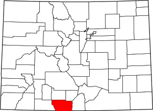 Map of Colorado highlighting Conejos County | |
| CDPs | ||
| Unincorporated communities | ||
| ||