Carbonville, Utah
Carbonville is a census-designated place in Carbon County, Utah, United States. The population was 1,567 at the 2010 census.[4]
Carbonville, Utah | |
|---|---|
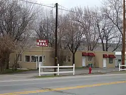 KOAL Radio studio in Carbonville | |
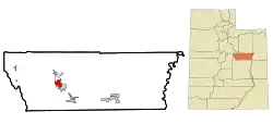 Location in Carbon County and the state of Utah | |
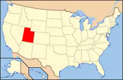 Location of Utah in the United States | |
| Coordinates: 39°37′21″N 110°50′05″W | |
| Country | United States |
| State | Utah |
| County | Carbon |
| Named for | Carbon County |
| Area | |
| • Total | 5.6 sq mi (14.4 km2) |
| • Land | 5.6 sq mi (14.4 km2) |
| • Water | 0.0 sq mi (0.0 km2) |
| Elevation | 5,623 ft (1,714 m) |
| Population | |
| • Total | 1,567 |
| • Density | 282/sq mi (108.8/km2) |
| Time zone | UTC-7 (Mountain (MST)) |
| • Summer (DST) | UTC-6 (MDT) |
| ZIP code | 84501 |
| Area code(s) | 435 |
| GNIS feature ID | 2584758[2] |
Geography
Carbonville lies just northwest of Price, the county seat of Carbon County. The Price River and U.S. Route 6 run past on the west, and the historic community of Spring Glen is to the north.
History
Carbonville was one of the first settlement sites in what became Carbon County. Caleb Rhoades built a dugout here in 1877, before moving on to found Price in 1879. Later called "Rhoades Meadow", the place had plenty of water, but of poor quality.[5]
The village grew slowly, with most immigrants preferring the more developed areas of Price and Spring Glen. Carbonville did experience rapid growth in the industrial and housing boom years after World War II. The Church of Jesus Christ of Latter-day Saints organized the first ward here in the late 1940s, and a second one in the 1950s.[6]
Demographics
As of the census[3] of 2010, there were 1,567 people living in the CDP. There were 669 housing units. The racial makeup of the CDP was 90.0% White, 0.3% Black or African American, 1.6% American Indian and Alaska Native, 0.1% Asian, 0.1% Native Hawaiian and Other Pacific Islander, 5.7% from some other race, and 2.2% from two or more races. Hispanic or Latino of any race were 12.3% of the population.
References
- "2010 Census U.S. Gazetteer File for Places: Utah". Archived from the original on April 11, 2011. Retrieved July 19, 2012.
- U.S. Geological Survey Geographic Names Information System: Carbonville. Retrieved May 23, 2011.
- "American FactFinder". United States Census Bureau. Archived from the original on February 12, 2020. Retrieved July 20, 2012.
- "Geographic Identifiers: 2010 Census Summary File 1 (G001): Carbonville CDP, Utah". U.S. Census Bureau, American Factfinder. Archived from the original on February 13, 2020. Retrieved August 11, 2015.
- Watt, Ronald G. (January 1997). A History of Carbon County (PDF). Utah Centennial County History Series. Salt Lake City, Utah: Utah State Historical Society. pp. 22–23. ISBN 0-913738-15-8. Retrieved July 16, 2012.
- Watt, pp.234–235.
External links
![]() Media related to Carbonville, Utah at Wikimedia Commons
Media related to Carbonville, Utah at Wikimedia Commons
Municipalities and communities of Carbon County, Utah, United States | ||
|---|---|---|
| Cities | 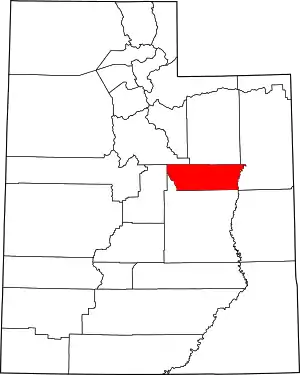 Map of Utah highlighting Carbon County | |
| Town | ||
| CDPs | ||
| Indian reservation | ||
| Ghost towns | ||
| Footnotes | ‡This populated place also has portions in an adjacent county or counties | |
| ||