Carl Junction, Missouri
Carl Junction is a city in Jasper County, Missouri, United States. The population was 7,445 at the 2010 census.
Carl Junction, Missouri | |
|---|---|
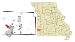 Location of Carl Junction, Missouri | |
| Coordinates: 37°10′18″N 94°33′9″W | |
| Country | United States |
| State | Missouri |
| County | Jasper |
| Government | |
| • Mayor | Mark Powers |
| Area | |
| • Total | 5.61 sq mi (14.52 km2) |
| • Land | 5.47 sq mi (14.17 km2) |
| • Water | 0.13 sq mi (0.34 km2) |
| Elevation | 896 ft (273 m) |
| Population | |
| • Total | 7,445 |
| • Estimate (2019)[3] | 8,274 |
| • Density | 1,512.06/sq mi (583.80/km2) |
| Time zone | UTC-6 (Central (CST)) |
| • Summer (DST) | UTC-5 (CDT) |
| ZIP code | 64834 |
| Area code(s) | 417 |
| FIPS code | 29-11368[4] |
| GNIS feature ID | 0715396[5] |
| Website | carljunction |
History
Carl Junction was laid out near a railroad junction by Charles Carl, who gave the town his last name.[6] A post office called Carl Junction has been in operation since 1878.[7]
Carl Junction has a recent history of violent tornadoes. The city was struck by an F3 tornado on May 4, 2003. On May 22, 2019, the city was hit with an EF3 tornado, causing damage to several buildings.
Geography
Carl Junction is located at 37°10′18″N 94°33′9″W (37.171804, -94.552557).[8]
According to the United States Census Bureau, the city has a total area of 5.61 square miles (14.53 km2), of which 5.48 square miles (14.19 km2) is land and 0.13 square miles (0.34 km2) is water.[9]
Carl Junction is approximately eight miles from Joplin.
Demographics
| Historical population | |||
|---|---|---|---|
| Census | Pop. | %± | |
| 1890 | 699 | — | |
| 1900 | 1,177 | 68.4% | |
| 1910 | 1,115 | −5.3% | |
| 1920 | 1,377 | 23.5% | |
| 1930 | 1,042 | −24.3% | |
| 1940 | 1,039 | −0.3% | |
| 1950 | 1,006 | −3.2% | |
| 1960 | 1,220 | 21.3% | |
| 1970 | 1,661 | 36.1% | |
| 1980 | 3,937 | 137.0% | |
| 1990 | 4,123 | 4.7% | |
| 2000 | 5,294 | 28.4% | |
| 2010 | 7,445 | 40.6% | |
| 2019 (est.) | 8,274 | [3] | 11.1% |
| U.S. Decennial Census | |||
Carl Junction is part of the Joplin, Missouri Metropolitan Statistical Area.
2010 census
As of the census[2] of 2010, there were 7,445 people, 2,616 households, and 2,061 families living in the city. The population density was 1,358.6 inhabitants per square mile (524.6/km2). There were 2,769 housing units at an average density of 505.3 per square mile (195.1/km2). The racial makeup of the city was 93.3% White, 1.0% African American, 1.3% Native American, 1.0% Asian, 0.8% from other races, and 2.6% from two or more races. Hispanic or Latino of any race were 2.9% of the population.
There were 2,616 households, of which 45.5% had children under the age of 18 living with them, 63.3% were married couples living together, 11.4% had a female householder with no husband present, 4.1% had a male householder with no wife present, and 21.2% were non-families. 17.9% of all households were made up of individuals, and 8.6% had someone living alone who was 65 years of age or older. The average household size was 2.84 and the average family size was 3.18.
The median age in the city was 34.7 years. 31.4% of residents were under the age of 18; 6.5% were between the ages of 18 and 24; 27.6% were from 25 to 44; 22.8% were from 45 to 64; and 11.6% were 65 years of age or older. The gender makeup of the city was 48.2% male and 51.8% female.
2000 census
As of the census[4] of 2000, there were 5,294 people, 1,871 households, and 1,534 families living in the city. The population density was 1,084.6 people per square mile (418.9/km2). There were 2,006 housing units at an average density of 411.0 per square mile (158.7/km2). The racial makeup of the city was 96.11% White, 0.43% African American, 1.27% Native American, 0.36% Asian, 0.1% Dutch, 0.2% Other from other races, and 1.49% from two or more races. Hispanic or Latino of any race were 1.51% of the population.
There were 1,871 households, out of which 45.5% had individuals under the age of 18, 70.0% were married couples living together, 9.0% had a female householder with no husband present, and 18.0% were non-families. 15.6% of all households were made up of individuals, and 6.5% had someone living alone who was 65 years of age or older. The average household size was 2.81 and the average family size was 3.12.
In the city the population was spread out, with 30.0% under the age of 18, 7.2% from 18 to 24, 30.8% from 25 to 44, 22.8% from 45 to 64, and 9.3% who were 65 years of age or older. The median age was 34 years. For every 100 females, there were 95.3 males. For every 100 females age 18 and over, there were 91.6 males.
The median income for a household in the city was $42,575, and the median income for a family was $47,723. Males had a median income of $32,583 versus $23,176 for females. The per capita income for the city was $18,291. About 3.2% of families and 5.1% of the population were below the poverty line, of those individuals below the poverty line, 41.8% were under 18 years of age and 10.4% were over 65 years of age.
References
- "2019 U.S. Gazetteer Files". United States Census Bureau. Retrieved July 26, 2020.
- "U.S. Census website". United States Census Bureau. Retrieved 2012-07-08.
- "Population and Housing Unit Estimates". United States Census Bureau. May 24, 2020. Retrieved May 27, 2020.
- "U.S. Census website". United States Census Bureau. Retrieved 2008-01-31.
- "US Board on Geographic Names". United States Geological Survey. 2007-10-25. Retrieved 2008-01-31.
- "Jasper County Place Names, 1928–1945 (archived)". The State Historical Society of Missouri. Archived from the original on 24 June 2016. Retrieved 18 October 2016.CS1 maint: bot: original URL status unknown (link)
- "Post Offices". Jim Forte Postal History. Archived from the original on 18 October 2016. Retrieved 18 October 2016.
- "US Gazetteer files: 2010, 2000, and 1990". United States Census Bureau. 2011-02-12. Retrieved 2011-04-23.
- "US Gazetteer files 2010". United States Census Bureau. Archived from the original on 2012-07-02. Retrieved 2012-07-08.
External links
- https://web.archive.org/web/20140815134909/http://factfinder2.census.gov/faces/tableservices/jsf/pages/productview.xhtml?src=bkmk
- Carl Junction R-1 School District
- Carl Junction Home Page
Municipalities and communities of Jasper County, Missouri, United States | ||
|---|---|---|
| Cities | 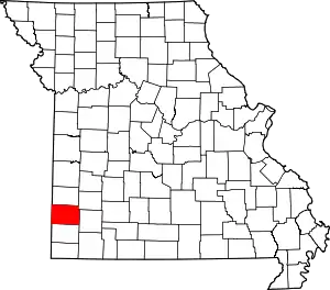 Map of Missouri highlighting Jasper County | |
| Villages | ||
| Townships | ||
| Unincorporated communities | ||
| Ghost town | ||
| Footnotes | ‡This populated place also has portions in an adjacent county or counties | |
| ||