Carlingwood
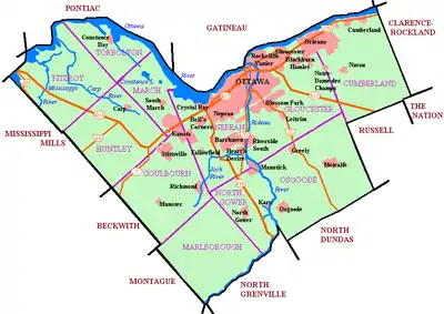
Carlingwood[1] is a neighbourhood in Bay Ward in the west end of Ottawa, Ontario, Canada. The neighbourhood is roughly bounded on the north by Richmond Road, on the east by Sherbourne Road, on the south by Carling Avenue and on the west by Woodroffe Avenue. This area corresponds to census tract 5050032.01, which had a population of 3,558 according to the Canada 2016 Census.[2]
Carlingwood | |
|---|---|
Neighbourhood | |
 Westwood Park | |
 Carlingwood | |
| Coordinates: 45.37617°N 75.76907°W | |
| Country | Canada |
| Province | Ontario |
| City | Ottawa |
| Government | |
| • MPs | Anita Vandenbeld |
| • MPPs | Jeremy Roberts |
| • Councillors | Theresa Kavanagh |
| • Governing body | Carlingwood Community Association |
| Area | |
| • Total | 0.779 km2 (0.301 sq mi) |
| Elevation | 70 m (230 ft) |
| Population | |
| • Total | 3,558 |
| • Density | 4,600/km2 (12,000/sq mi) |
| Time zone | Eastern (EST) |
| Forward sortation area | K2A |
| Website | Carlingwood Community Association |
The Carlingwood Shopping Centre was built in 1956 at the corner of Carling and Woodroffe. The surrounding neighbourhood would be built later in the decade.[3] Somserset Towers and the Saville Apartments (then known as Saville Terrace)[4] were built in the early 1960s, and Bromley Square was built in the early 1970s.
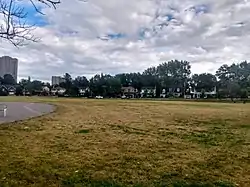
Carlingwood is home to two parks, Westwood and Woodroffe. It is also home of Woodroffe Avenue Public School, Our Lady of Fatima School and the Ottawa Public Library Carlingwood Branch. Churches in Carlingwood include Our Lady of Fatima Catholic, Ukrainian Orthodox Cathedral Assumption Of The Blessed Virgin, Woodroffe United, St. Martin's Anglican, and Bromley Road Baptist.
References
- "Carlingwood". Geographical Names Data Base. Natural Resources Canada.
- https://www12.statcan.gc.ca/census-recensement/2016/dp-pd/prof/details/page.cfm?Lang=E&Geo1=CT&Code1=5050032.01&Geo2=PR&Code2=01&Data=Count&SearchText=5050032.01&SearchType=Begins&SearchPR=01&B1=All&Custom=&TABID=3
- GeoOttawa areal maps - 1958
- "Saville Terrace". Ottawa Citizen. August 26, 1963. Retrieved July 18, 2020.
Places adjacent to Carlingwood | |
|---|---|
