Castelnuovo Parano
Castelnuovo Parano is a comune (municipality) in the province of Frosinone in the Italian region Lazio, located about 120 kilometres (75 miles) southeast of Rome and about 45 kilometres (28 mi) southeast of Frosinone.
Castelnuovo Parano | |
|---|---|
| Comune di Castelnuovo Parano | |
 Coat of arms | |
Location of Castelnuovo Parano 
| |
 Castelnuovo Parano Location of Castelnuovo Parano in Italy 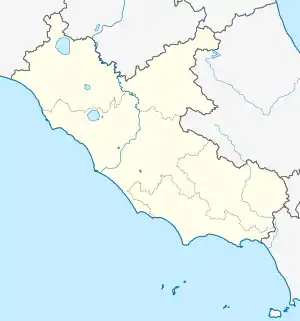 Castelnuovo Parano Castelnuovo Parano (Lazio) | |
| Coordinates: 41°22′N 13°45′E | |
| Country | Italy |
| Region | Lazio |
| Province | Frosinone (FR) |
| Frazioni | Casali, Terra, Valli-Sant'Antonio, Cisterna, Pimpinelli |
| Government | |
| • Mayor | Oreste De Bellis |
| Area | |
| • Total | 9.88 km2 (3.81 sq mi) |
| Elevation | 310 m (1,020 ft) |
| Population (28 February 2017)[2] | |
| • Total | 884 |
| • Density | 89/km2 (230/sq mi) |
| Demonym(s) | Castelnovesi |
| Time zone | UTC+1 (CET) |
| • Summer (DST) | UTC+2 (CEST) |
| Postal code | 03040 |
| Dialing code | 0776 |
| Patron saint | St. Maurus |
| Saint day | 15 January |
| Website | Official website |
It originates from a castle built here in 1059 by abbot Desiderius of Montecassino to defend the area between Fratte and Traetto. The area was severely damaged during World War II due to its position across the Gustav Line. After the end of the conflict, much of the population emigrated.
References
- "Superficie di Comuni Province e Regioni italiane al 9 ottobre 2011". Istat. Retrieved 16 March 2019.
- All demographics and other statistics: Italian statistical institute Istat.
| Authority control |
|
|---|
This article is issued from Wikipedia. The text is licensed under Creative Commons - Attribution - Sharealike. Additional terms may apply for the media files.
