Catthorpe
Catthorpe is a village and civil parish in the Harborough district of Leicestershire, England. It is located beside the River Avon and close to the A5 road, and hence close to the tripoint at Dow Bridge formed by Leicestershire, Northamptonshire and Warwickshire; the nearest towns are Rugby, in Warwickshire around 4 miles (6.4 km) to the southwest, and Lutterworth around 4 miles (6.4 km) to the north. At the 2001 Census, the parish had a population of 179, falling slightly to 173 at the 2011 census.[1]
| Catthorpe | |
|---|---|
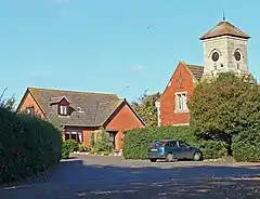 Lilbourne Lane, Catthorpe in October 2007 | |
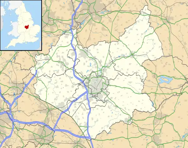 Catthorpe Location within Leicestershire | |
| Population | 173 (2011) |
| OS grid reference | SP552780 |
| Civil parish |
|
| District | |
| Shire county | |
| Region | |
| Country | England |
| Sovereign state | United Kingdom |
| Post town | LUTTERWORTH |
| Postcode district | LE17 |
| Dialling code | 01788 |
| Police | Leicestershire |
| Fire | Leicestershire |
| Ambulance | East Midlands |
| UK Parliament | |
Catthorpe gives its name to the nearby Catthorpe Interchange road junction formed by the M1 and M6 motorways and the A14 road, which was known to be regularly congested owing to its non-standard design. The A14 passed under both motorways; these underpasses were built in the 1960s for the former A427, which passed through Catthorpe. Between 2014 and 2016 the interchange was the subject of a major redesign to reduce the congestion and improve safety by providing free-flowing links and removing direct access from the local road network.[2]
Between 1850 and 1966 Catthorpe was served by the nearby Lilbourne railway station on the now dismantled Rugby to Peterborough Line
Catthorpe briefly came to national attention in 1999 when the Latvian alleged war criminal Konrāds Kalējs was revealed to be living at Catthorpe Manor, a nursing home near the village.[3]
The parish church, dedicated to St Thomas, dates from the 14th century and is Grade II* listed, but is currently on Historic England's Heritage at Risk Register as being in a 'vary bad' state due to masonry defects and heritage crime.[4][5] There is a village pub called the Cherry Tree and farm shop and restaurant, both are located on Main Street.
References
- "CATTHORPE Parish in East Midlands". City Population. Retrieved 20 October 2018.
- "M1 Junction 19 Improvement Scheme". Highways England. Archived from the original on 19 October 2018. Retrieved 18 October 2018.
- "Police examine 'Nazi' war record". BBC News. 29 December 1999. Retrieved 27 March 2014.
- "Church of St Thomas, Catthorpe". British Listed Buildings. Retrieved 27 August 2015.
- Heritage at Risk 2018 - East Midlands (Report). Historic England. p. 37. Retrieved 3 February 2019.