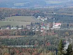
Chartierville, Quebec
Chartierville is a small municipality of about 300 people in Le Haut-Saint-François Regional County Municipality, in the Estrie region of Quebec, Canada, on the Canada–United States border.
Chartierville | |
|---|---|
 | |
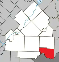 Location within Le Haut-Saint-François RCM | |
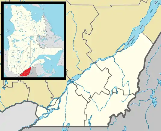 Chartierville Location in southern Quebec | |
| Coordinates: 45.3°N 71.2°W[1] | |
| Country | |
| Province | |
| Region | Estrie |
| RCM | Le Haut-Saint-François |
| Constituted | January 1, 1879 |
| Government | |
| • Mayor | Jean Belhumeur |
| • Federal riding | Compton—Stanstead |
| • Prov. riding | Mégantic |
| Area | |
| • Total | 142.60 km2 (55.06 sq mi) |
| • Land | 140.93 km2 (54.41 sq mi) |
| Population | |
| • Total | 307 |
| • Density | 2.2/km2 (6/sq mi) |
| • Pop 2006-2011 | |
| Time zone | UTC−5 (EST) |
| • Summer (DST) | UTC−4 (EDT) |
| Postal code(s) | J0B 1K0 |
| Area code(s) | 819 |
| Highways | |
| Website | www |
Chartierville is located on Route 257 South. Prior to its founding in 1870 by colonists from Saint-Hyacinthe, gold-seekers flocked to the area. This patch of land, 139 km square and 505 metres in altitude, is one of the highest regions in Quebec.
Magnetic Hill
A local attraction of interest is Magnetic Hill (Côte Magnétique), a gravity hill.[4]
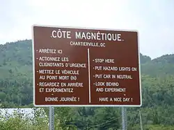
Magnetic Hill in Chartierville, Quebec
References
- Reference number 12580 of the Commission de toponymie du Québec (in French)
- Geographic code 41020 in the official Répertoire des municipalités (in French)
- "(Code 2441020) Census Profile". 2011 census. Statistics Canada. 2012.
- Rogers, Barbar Radcliffe (August 2015). New Hampshire's Northern Tip, nhmagazine.com
External links
 Media related to Chartierville at Wikimedia Commons
- Official website of the Municipality of Chartierville
Places adjacent to Chartierville, Quebec | |
|---|---|
| Cities & Towns | |
|---|---|
| Municipalities | |
| Townships | |
| |
| Authority control |
|
|---|
This article is issued from Wikipedia. The text is licensed under Creative Commons - Attribution - Sharealike. Additional terms may apply for the media files.