Chillicothe, Iowa
Chillicothe (/tʃɪləˈkɒθiː/[5]) is a city in Wapello County, Iowa, United States. The population was 97 at the 2010 census.
Chillicothe, Iowa | |
|---|---|
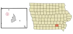 Location of Chillicothe, Iowa | |
| Coordinates: 41°5′11″N 92°31′44″W | |
| Country | |
| State | |
| County | Wapello |
| Incorporated | December 22, 1881 [1] |
| Area | |
| • Total | 0.24 sq mi (0.62 km2) |
| • Land | 0.23 sq mi (0.59 km2) |
| • Water | 0.01 sq mi (0.03 km2) |
| Elevation | 686 ft (209 m) |
| Population | |
| • Total | 97 |
| • Estimate (2019)[4] | 97 |
| • Density | 427.31/sq mi (164.88/km2) |
| Time zone | UTC-6 (Central (CST)) |
| • Summer (DST) | UTC-5 (CDT) |
| ZIP code | 52548 |
| Area code(s) | 641 |
| FIPS code | 19-13215 |
| GNIS feature ID | 0455394 |
History
Chillicothe was laid out in 1849[6] and was incorporated in 1881.[7]
The word "Chillicothe" is derived from the ancient Shawnee Indian words meaning "Principal Place." It was the name for one of their clans. The main chief of the Shawnee could only come from the Chillicothe clan. When a village was called Chillicothe, it meant that it was home to the principal chief. It was the capital city of the Shawnees until the death of that chief. Then, the capitol would move to the home village of the next main chief. That village would then become Chillicothe.[8]
Chillicothe is the burial place of the oldest man to serve in the Civil War, Curtis King.[9][10]
Geography
Chillicothe is located at 41°5′11″N 92°31′44″W (41.086443, -92.528751).[11]
According to the United States Census Bureau, the city has a total area of 0.24 square miles (0.62 km2), of which 0.23 square miles (0.60 km2) is land and 0.01 square miles (0.03 km2) is water.[12]
Demographics
| Year | Pop. | ±% |
|---|---|---|
| 1870 | 211 | — |
| 1880 | 234 | +10.9% |
| 1890 | 214 | −8.5% |
| 1900 | 216 | +0.9% |
| 1910 | 181 | −16.2% |
| 1920 | 146 | −19.3% |
| 1930 | 156 | +6.8% |
| 1940 | 173 | +10.9% |
| 1950 | 196 | +13.3% |
| 1960 | 148 | −24.5% |
| 1970 | 126 | −14.9% |
| 1980 | 131 | +4.0% |
| 1990 | 119 | −9.2% |
| 2000 | 90 | −24.4% |
| 2010 | 97 | +7.8% |
| 2019 | 97 | +0.0% |
| Source:"U.S. Census website". United States Census Bureau. Retrieved 2020-03-29. and Iowa Data Center Source: | ||
2010 census
As of the census[3] of 2010, there were 97 people, 35 households, and 21 families residing in the city. The population density was 421.7 inhabitants per square mile (162.8/km2). There were 45 housing units at an average density of 195.7 per square mile (75.6/km2). The racial makeup of the city was 100.0% White. Hispanic or Latino of any race were 1.0% of the population.
There were 35 households, of which 37.1% had children under the age of 18 living with them, 48.6% were married couples living together, 5.7% had a female householder with no husband present, 5.7% had a male householder with no wife present, and 40.0% were non-families. 28.6% of all households were made up of individuals, and 8.6% had someone living alone who was 65 years of age or older. The average household size was 2.77 and the average family size was 3.33.
The median age in the city was 35.5 years. 27.8% of residents were under the age of 18; 12.4% were between the ages of 18 and 24; 22.7% were from 25 to 44; 27.9% were from 45 to 64; and 9.3% were 65 years of age or older. The gender makeup of the city was 48.5% male and 51.5% female.
2000 census
As of the census[14] of 2000, there were 90 people, 38 households, and 25 families residing in the city. The population density was 395.7 people per square mile (151.1/km2). There were 44 housing units at an average density of 193.4 per square mile (73.9/km2). The racial makeup of the city was 97.78% White, 1.11% Asian, and 1.11% from two or more races.
There were 38 households, out of which 28.9% had children under the age of 18 living with them, 50.0% were married couples living together, 7.9% had a female householder with no husband present, and 34.2% were non-families. 28.9% of all households were made up of individuals, and 10.5% had someone living alone who was 65 years of age or older. The average household size was 2.37 and the average family size was 2.96.
Population spread: 27.8% under the age of 18, 5.6% from 18 to 24, 26.7% from 25 to 44, 30.0% from 45 to 64, and 10.0% who were 65 years of age or older. The median age was 41 years. For every 100 females, there were 114.3 males. For every 100 females age 18 and over, there were 109.7 males.
The median income for a household in the city was $30,781, and the median income for a family was $31,750. Males had a median income of $25,417 versus $25,625 for females. The per capita income for the city was $19,075. There were 12.0% of families and 13.8% of the population living below the poverty line, including 33.3% of under eighteens and none of those over 64.
Education
Chillicothe is within the Eddyville–Blakesburg–Fremont Community School District,[15] formed by the 2012 merger of the Eddyville–Blakesburg Community School District and the Fremont Community School District.[16] It previously resided in the Eddyville–Blakesburg district,[17] which was formed in 1994 by the merger of the Eddyville Community School District and the Blakesburg Community School District.[16]
Infrastructure
On the west side of town is a large coal-burning power plant that supplies power to a large part of southeastern Iowa.
The town also rates a bridge across the Des Moines River.
References
- "Chillicothe, Iowa". City-Data. Retrieved January 23, 2011.
- "2019 U.S. Gazetteer Files". United States Census Bureau. Retrieved July 17, 2020.
- "U.S. Census website". United States Census Bureau. Retrieved 2012-05-11.
- "Population and Housing Unit Estimates". United States Census Bureau. May 24, 2020. Retrieved May 27, 2020.
- https://www.iowapublicradio.org/post/pronouncing-iowa-place-names-audio-guide-expanded-100-entries#stream/0
- Evans, Samuel B. (1901). History of Wapello County, Iowa, and Representative Citizens. Higginson Book Company. p. 149.
- Waterman, Harrison Lyman (1914). History of Wapello County, Iowa, Volume 1. S. J. Clarke Publishing Company. p. 353.
- Chillicothe City History
- Ottumwa Courier
- Oskaloosa Herald
- "US Gazetteer files: 2010, 2000, and 1990". United States Census Bureau. 2011-02-12. Retrieved 2011-04-23.
- "US Gazetteer files 2010". United States Census Bureau. Archived from the original on 2012-01-25. Retrieved 2012-05-11.
- "Census of Population and Housing". Census.gov. Retrieved June 4, 2015.
- "U.S. Census website". United States Census Bureau. Retrieved 2008-01-31.
- "Eddysville-Blakesburg-Fremont." Iowa Department of Education. Retrieved on January 17, 2019.
- "REORGANIZATION & DISSOLUTION ACTIONS SINCE 1965-66 Archived 2019-02-09 at the Wayback Machine." Iowa Department of Education. Retrieved on January 14, 2019.
- "Eddyville-Blakesburg Community School District." Iowa Secretary of State. Retrieved on January 17, 2019. Detail maps: Eddyville, Eddyville and Kirkville, Blakesburg.
External links
- City-Data Comprehensive Statistical Data and more about Chillicothe
Municipalities and communities of Wapello County, Iowa, United States | ||
|---|---|---|
| Cities | Map of Iowa highlighting Wapello County | |
| Townships | ||
| Unincorporated communities | ||
| Footnotes | ‡This populated place also has portions in an adjacent county or counties | |
| ||
