Ciron
The Ciron is a left tributary of the Garonne, in Gironde, Southwest France. It is 96.9 km (60.2 mi) long.[1]
| Ciron | |
|---|---|
 | |
| Location | |
| Country | France |
| Physical characteristics | |
| Source | |
| • location | Landes |
| • elevation | 135 m (443 ft) |
| Mouth | |
• location | Garonne |
• coordinates | 44°36′3″N 0°18′5″W |
| Length | 97 km (60 mi) |
| Discharge | |
| • average | 3 m3/s (110 cu ft/s) |
| Basin features | |
| Progression | Garonne→ Gironde estuary→ Atlantic Ocean |
Geography
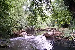
The Ciron rises in the eastern end of the Moors of Gascony, in Landes. It flows north-west, mainly through the moors of Gironde, crosses the Sauternes vineyard and joins the Garonne at Barsac, downstream from Langon.
The moisture it brings, and morning mists it causes, are favorable to the development of Botrytis cinerea on grapes, a fungus that contributes to the high quality and renown of Sauternes wines.
Départements and towns
The Ciron flows through the following départements and towns:
- Landes (40) : Lubbon
- Lot-et-Garonne (47)
- Gironde (33) : Noaillan, Villandraut, Barsac, Cérons, Bommes
Tributaries
- (L) le Giscos, from Giscos
- (R) le Barthos,
- (L) la Gouaneyre, from Captieux
- (R) la Clède, from Lignan-de-Bazas
- (L) le Baillon, downstream from Villandraut
- (L) la Hure, from Saint-Symphorien
- (L) l'Origne from Origne and Balizac
- (L) le Tursan, from Guillos
- (L) la Mouliasse, from Landiras
N.B. : (R) = right tributary; (L) = left tributary
References
External links
This article is issued from Wikipedia. The text is licensed under Creative Commons - Attribution - Sharealike. Additional terms may apply for the media files.
